Sites and Monuments Record · Ireland
Church
Ceathrú An Lisín, County Galway, Ireland
The record
- Townland
- Ceathrú An Lisín
- County
- Galway
- Country
- Ireland
- First-edition OS map
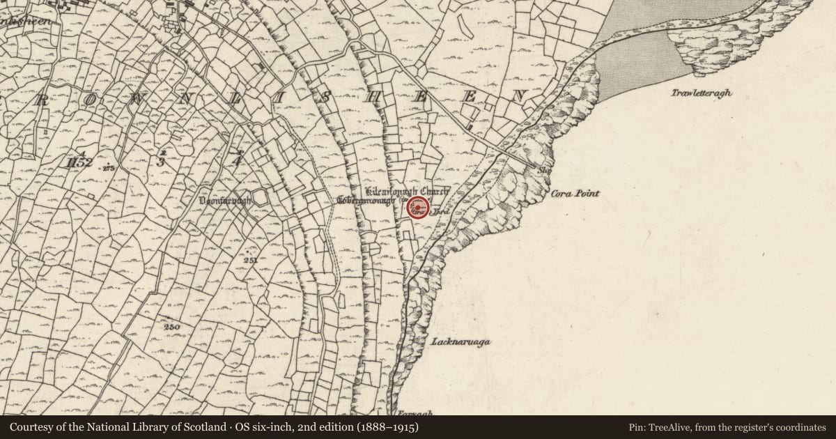
- Kilcanonagh Church (in Ruins)
- Latest-edition OS map
- Kilcanonagh Church (in Ruins)
- Coordinates
- 53.08059, -9.57552
- SMR number
- GA119-087001-
Slide toward Today to fade the historical sheet and see the modern map underneath.
David Rumsey Map Collection, Stanford LibrariesDavid Rumsey Map Collection, Stanford LibrariesDavid Rumsey Map Collection, Stanford LibrariesDavid Rumsey Map Collection, Stanford Libraries
4 historical maps cover this location, the earliest the 1753 map "Mappa geographica Regni Hiberniae" (David Rumsey Map Collection, Stanford Libraries).
Historical maps covering this location
- 1753 · Mappa geographica Regni Hiberniae (David Rumsey Map Collection, Stanford Libraries)
- 1790 · Composite: Ireland. (David Rumsey Map Collection, Stanford Libraries)
- 1869 · Ireland. (David Rumsey Map Collection, Stanford Libraries)
- 1891 · Ireland 16 (David Rumsey Map Collection, Stanford Libraries)
This record in the National Monuments Service's Historic Environment Viewer ↗
The National Monuments Service's description
Close to shore on E side of Inis Meáin. Cill Cheannanach is a well-preserved E. Chr. oratory (E-W; L 5.19m, Wth 3.95m ext.) with a trabeate doorway in W gable and a triangular-headed window in E one. Projecting corbels survive on three of the corners. It stands at N end of graveyard (GA119-087002-), which also contains a crudely dressed triangular holed stone (possibly the endstone of a slab shrine; GA119-087004-). There is a holy well (GA119-087003-) to NNW. (O'Flanagan 1927a, Vol. 3, 318, 407-9; Anon. 1886a, 196; Westropp 1895, 268-70)
The above description is derived from the published 'Archaeological Inventory of County Galway Vol. I - West Galway'. Compiled by Paul Gosling (Dublin: Stationery Office, 1993).
Date of upload: 05 August 2010
The monument was taken into Ownership under the National Monuments Acts 1930 to 2014 - National Monument 42.
References
Westropp, T.J. 1895 Proceedings: Aran Islands. Journal of the Royal Society of Antiquaries of Ireland 25, 250-74.
O'Flanagan, Rev. M. (Compiler) 1927 Letters containing information relative to the antiquities of the county of Galway collected during the progress of the Ordnance Survey in 1839. Typescript in 3 vols. Bray.
Anon. 1886a Antiquities of the Aran Islands, County of Galway. The Irish Builder, July 1886, 196-7, 301.
Nearby in the register
- Shrineunder 1 mi
- Graveyardunder 1 mi
- Ritual site - holy wellunder 1 mi
- Burial groundunder 1 mi
Other entries of the same register within about three miles of this one, by straight line.