Sites and Monuments Record · Ireland
Cross - High cross
Cill Éinne, County Galway, Ireland
The record
- Townland
- Cill Éinne
- County
- Galway
- Country
- Ireland
- First-edition OS map
- Not indicated
- Latest-edition OS map
- Cross
- Coordinates
- 53.10334, -9.66301
- SMR number
- GA119-006004-
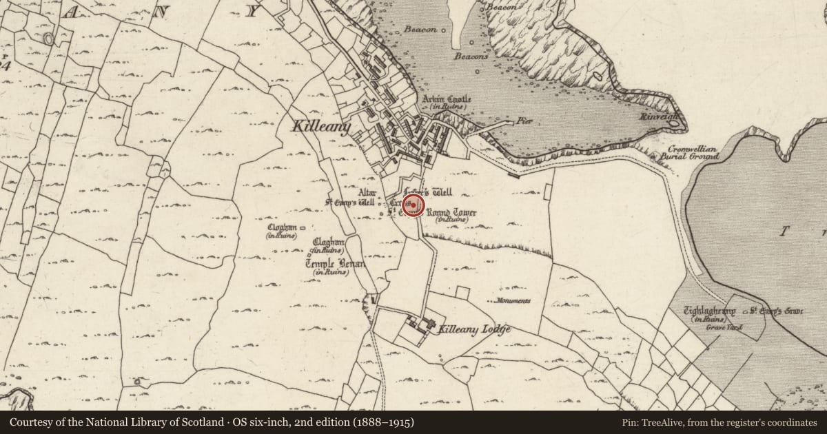
Slide toward Today to fade the historical sheet and see the modern map underneath.
David Rumsey Map Collection, Stanford LibrariesDavid Rumsey Map Collection, Stanford LibrariesDavid Rumsey Map Collection, Stanford LibrariesDavid Rumsey Map Collection, Stanford Libraries
4 historical maps cover this location, the earliest the 1753 map "Mappa geographica Regni Hiberniae" (David Rumsey Map Collection, Stanford Libraries).
Historical maps covering this location
- 1753 · Mappa geographica Regni Hiberniae (David Rumsey Map Collection, Stanford Libraries)
- 1790 · Composite: Ireland. (David Rumsey Map Collection, Stanford Libraries)
- 1869 · Ireland. (David Rumsey Map Collection, Stanford Libraries)
- 1891 · Ireland 16 (David Rumsey Map Collection, Stanford Libraries)
This record in the National Monuments Service's Historic Environment Viewer ↗
The National Monuments Service's description
Associated with St Enda's monastery on Inis Mór (GA119-006006-). Two portions of a limestone cross are cemented together on a modern plinth. The shaft (Wth 0.45m, T 0.23m, H 1.15m) bears decoration on four faces including fret patterns and Ringerike-style ornament. Henry (1970, 136-8) has suggested that these cross fragments, along with those at Teaghlach Éinne (GA119-020011-), originally formed part of the same high cross. (Crawford 1907, 213; Anon. 1897, 267)
The above description is derived from the published 'Archaeological Inventory of County Galway Vol. I - West Galway'. Compiled by Paul Gosling (Dublin: Stationery Office, 1993).
Date of upload: 05 August 2010
This monument was taken into Ownership under the National Monuments Acts 1930 to 2014 - National Monument 43.
References
Crawford, H.S. 1907 A descriptive list of early Irish crosses. Journal of the Royal Society of Antiquaries of Ireland 37, 187-239; 43, 151-69, 261-65, 326-34.
Anon. 1897f Proceedings: cruise in connexion with the Munster meeting; from Galway Bay to Waterford Harbour. Journal of the Royal Society of Antiquaries of Ireland 27, 265-358.
Henry, F. 1970 Irish art in the Romanesque period (1020-1170 A.D.). London. Methuen.
Nearby in the register
- Religious house - Franciscan friarsunder 1 mi
- Ritual site - holy wellunder 1 mi
- Round towerunder 1 mi
- Ritual site - holy wellunder 1 mi
Other entries of the same register within about three miles of this one, by straight line.