Sites and Monuments Record · Ireland
Bawn
Castlepark, County Galway, Ireland
The record
- Townland
- Castlepark
- County
- Galway
- Country
- Ireland
- First-edition OS map
- Not indicated
- Latest-edition OS map
- Hachured
- Coordinates
- 53.15834, -8.71887
- SMR number
- GA114-054001-
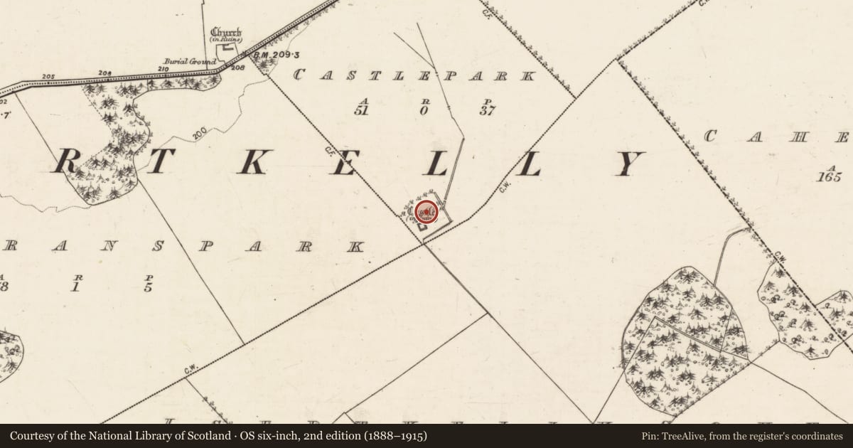
Slide toward Today to fade the historical sheet and see the modern map underneath.
David Rumsey Map Collection, Stanford LibrariesDavid Rumsey Map Collection, Stanford LibrariesDavid Rumsey Map Collection, Stanford LibrariesDavid Rumsey Map Collection, Stanford Libraries
4 historical maps cover this location, the earliest the 1753 map "Mappa geographica Regni Hiberniae" (David Rumsey Map Collection, Stanford Libraries).
Historical maps covering this location
- 1753 · Mappa geographica Regni Hiberniae (David Rumsey Map Collection, Stanford Libraries)
- 1790 · Composite: Ireland. (David Rumsey Map Collection, Stanford Libraries)
- 1869 · Ireland. (David Rumsey Map Collection, Stanford Libraries)
- 1891 · Ireland 16 (David Rumsey Map Collection, Stanford Libraries)
This record in the National Monuments Service's Historic Environment Viewer ↗
The National Monuments Service's description
This rectangular bawn (c. 62m NNW-SSE; c. 54m ENE-WSW) is associated with ‘Isert Kelly Castle’ (GA114-054----) which occupies it S corner. It is defined by a grassed-over tumbled stone wall (Wth 0.68m; int. H 0.7m; ext. H 0.53m), which is visible all round. Traces of inner and outer wall-facing survive intermittently. Stone-lined entrance gaps are evident in the S (Wth 1.56m) and W (Wth 2.57m) walls. A rectangular building (L 18.3m; Wth 8.4m), also defined by grassed-over tumbled stone walls, in the SE corner may be the remains of an associated banqueting hall. A small section of the masonry of its N wall has collapsed intact into its interior. A NE-SW flowing stream to the E of the bawn appears to have been channelled around it to form a moat-like feature along its E and S sides. Boulders visible along both banks suggest it was stone-faced. No clear trace of the ‘moat’ is evident along the W and N sides but a change in vegetation colour suggests it line. An enclosure (GA114-054002-) extending off the N side may be associated. Since 2014 the bawn has the subject of on-going research excavations being carried out by Dr Rory Sherlock, Galway Archaeological Field School (see https://excavations.ie/report/2017/Galway/0026239/ last accessed 11 June 2018).
The following images have been appended:
GA114-054001-_01 N bawn wall from E.jpg
GA114-054001-_02 N end of E bawn wall, from S.jpg
GA114-054001-_03 S bawn wall, from E.jpg
GA114-054001-_04 W bawn wall, from W.jpg
GA114-054001-_05 External wall-facing, W bawn wall.jpg
GA114-054001-_06 Gap in S wall, from S.jpg
GA114-054001-_07 Detail of wall-facing on E side of S gap.jpg
GA114-054001-_08 Gap in W wall, from W.jpg
GA114-054001-_09 Banqueting hall from SW.jpg
GA114-054001-_10 E wall of banqueting hall.jpg
GA114-054001-_11 Possible 'moat' feature on S side, from E.jpg
Compiled by: Olive Alcock
Date of upload: 11 June 2019
References
Sherlock, R. 2017 2017:337 Isert Kelly Castle, Galway. Available at: https://excavations.ie/report/2017/Galway/0026239/ last accessed 11 June 2019.
Nearby in the register
- Castle - tower houseunder 1 mi
- Enclosureunder 1 mi
- Graveyardunder 1 mi
- Churchunder 1 mi
Other entries of the same register within about three miles of this one, by straight line.