Sites and Monuments Record · Ireland
Church
Seefin, County Galway, Ireland
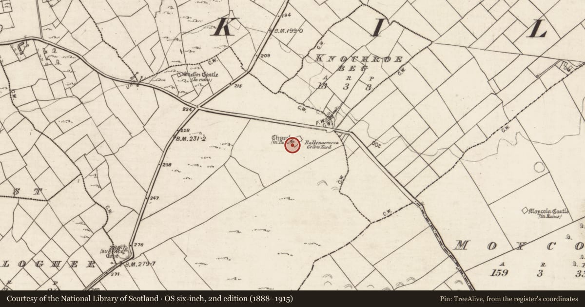
The record
- Townland
- Seefin
- County
- Galway
- Country
- Ireland
- First-edition OS map
- Church (in ruins)
- Latest-edition OS map
- Church (in Ruins)
- Coordinates
- 53.20775, -8.68136
- SMR number
- GA104-266----
Slide toward Today to fade the historical sheet and see the modern map underneath.
David Rumsey Map Collection, Stanford LibrariesDavid Rumsey Map Collection, Stanford LibrariesDavid Rumsey Map Collection, Stanford LibrariesDavid Rumsey Map Collection, Stanford Libraries
4 historical maps cover this location, the earliest the 1753 map "Mappa geographica Regni Hiberniae" (David Rumsey Map Collection, Stanford Libraries).
Historical maps covering this location
- 1753 · Mappa geographica Regni Hiberniae (David Rumsey Map Collection, Stanford Libraries)
- 1790 · Composite: Ireland. (David Rumsey Map Collection, Stanford Libraries)
- 1869 · Ireland. (David Rumsey Map Collection, Stanford Libraries)
- 1891 · Ireland 16 (David Rumsey Map Collection, Stanford Libraries)
This record in the National Monuments Service's Historic Environment Viewer ↗
The National Monuments Service's description
In pastureland within the W sector of a graveyard (GA104-266001-). The W gable (H 4.7m) and the W end of the S side-wall (H 1.5m) are the best preserved sections of this medieval church (15.4m E-W; 5m N-S; wall T 1m), otherwise only the grassed-over remains of the other walls (H 0.8m) indicate its outline. The gable wall, which is regularly coursed, is original to the height of an offset (H 2.25m; Wth 0.45m) that is visible on its internal face. Above this it has been rebuilt and some dressed stone is visible in its make-up. A corbel centrally placed in this wall suggests the former presence of a loft at this end of the church and this is further suggested by the top of an ogee-headed window on the ground outside the SW corner. No architectural features survive but a possible lintel stone from over the doorway has been incorporated into the graveyard wall. A font and the capstone of possible double font are visible in the interior, which is also occupied by a number of modern graves.
Compiled by: Olive Alcock
Date of upload: 2 April 2020
Nearby in the register
- Graveyardunder 1 mi
- Castle - tower houseunder 1 mi
- House - indeterminate dateunder 1 mi
- Ringfort - cashelunder 1 mi
Other entries of the same register within about three miles of this one, by straight line.