Sites and Monuments Record · Ireland
Castle - tower house
Oghil Beg, County Galway, Ireland
The record
- Townland
- Oghil Beg
- County
- Galway
- Country
- Ireland
- First-edition OS map
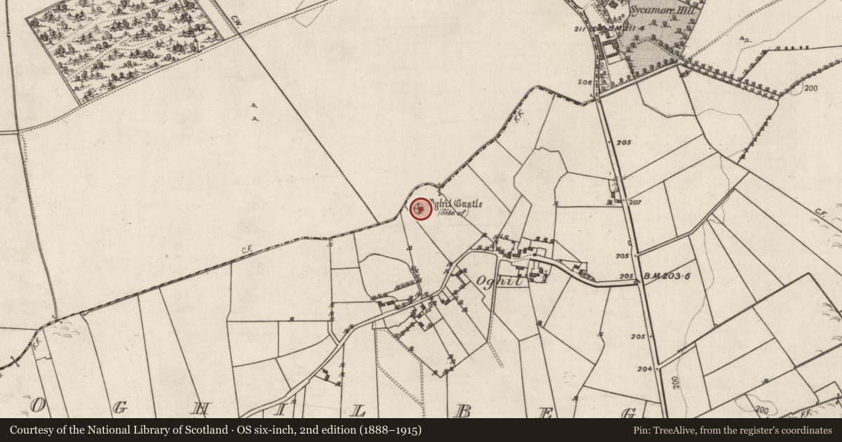
- Oghil Castle (in ruins)
- Latest-edition OS map
- Oghil Castle (Site of)
- Coordinates
- 53.25030, -8.18300
- SMR number
- GA100-138001-
Slide toward Today to fade the historical sheet and see the modern map underneath.
David Rumsey Map Collection, Stanford LibrariesDavid Rumsey Map Collection, Stanford LibrariesDavid Rumsey Map Collection, Stanford LibrariesDavid Rumsey Map Collection, Stanford Libraries
4 historical maps cover this location, the earliest the 1790 map "Composite: Ireland." (David Rumsey Map Collection, Stanford Libraries).
Historical maps covering this location
- 1790 · Composite: Ireland. (David Rumsey Map Collection, Stanford Libraries)
- 1811 · Ireland. (David Rumsey Map Collection, Stanford Libraries)
- 1869 · Ireland. (David Rumsey Map Collection, Stanford Libraries)
- 1891 · Ireland 16 (David Rumsey Map Collection, Stanford Libraries)
This record in the National Monuments Service's Historic Environment Viewer ↗
The National Monuments Service's description
On a slight rise in pastureland. All that survives of this castle is a scarped rectangular earthwork (25m E-W, 13.4m N-S; H 0.3-1m) that slopes gently from W to E. A low bank of earth and stone (Wth 1.5m; max. H 1m) runs N-S across it, just to the W of centre. To the W of this bank a series depressions are visible but a low grassed-over stony bank (Wth 1m) running along the W and N sides may indicate the foundation line of the castle walls. A number of hawthorn trees are growing to the E of the bank and the E face of the scarp is very denuded. Loose small stones visible on and around the earthwork appear to be field-clearance material but two large limestone blocks in a depression in the W part of it and two more visible in the E part may be the last vestiges of stonework from the castle. Possibly the remains of a tower house. The site of a nunnery (GA100-138002-) lay c. 25m to the SW.
Compiled by: Olive Alcock
Date of upload: 1 April 2020
Nearby in the register
- Religious house - unclassifiedunder 1 mi
- Country houseunder 1 mi
- Designed landscape featureunder 1 mi
- Fulacht fiaunder 1 mi
Other entries of the same register within about three miles of this one, by straight line.