Sites and Monuments Record · Ireland
Bridge
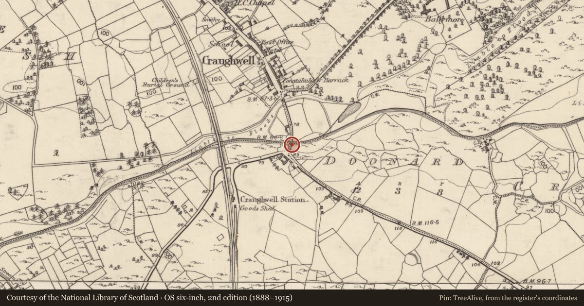
Ballymore (Craughwell ED),Craughwell (Dunkellin By.),Doonard,Killora, County Galway, Ireland
The record
- Townland
- Ballymore (Craughwell ED),Craughwell (Dunkellin By.),Doonard,Killora
- County
- Galway
- Country
- Ireland
- First-edition OS map
- Br.
- Latest-edition OS map
- Indicated
- Coordinates
- 53.22779, -8.73337
- SMR number
- GA096-185----
Slide toward Today to fade the historical sheet and see the modern map underneath.
David Rumsey Map Collection, Stanford LibrariesDavid Rumsey Map Collection, Stanford LibrariesDavid Rumsey Map Collection, Stanford LibrariesDavid Rumsey Map Collection, Stanford Libraries
4 historical maps cover this location, the earliest the 1753 map "Mappa geographica Regni Hiberniae" (David Rumsey Map Collection, Stanford Libraries).
Historical maps covering this location
- 1753 · Mappa geographica Regni Hiberniae (David Rumsey Map Collection, Stanford Libraries)
- 1790 · Composite: Ireland. (David Rumsey Map Collection, Stanford Libraries)
- 1869 · Ireland. (David Rumsey Map Collection, Stanford Libraries)
- 1891 · Ireland 16 (David Rumsey Map Collection, Stanford Libraries)
This record in the National Monuments Service's Historic Environment Viewer ↗
The National Monuments Service's description
Desribed as follows in the National Inventory of Architectural Heritage (Reg. No.: 30336010): 'Six-arch limestone road bridge over Craughwell River, built c.1600 and widened to west perhaps late seventeenth century and to east c.1780. Original bridge was ten feet wide, early widening added two feet and later widening added same width again as original bridge. Formerly in use as vehicular bridge, now bypassed and in use as pedestrian bridge. Well preserved wicker centring to soffits of earliest part, and partly hidden arch ring towards west side of bridge, is of irregular voussoirs. Rubble stone walls, piers and parapet walls. Piers apparently refaced in squared limestone blocks, perhaps at time of latest work. Segmental arches to east elevation with cut-stone voussoirs and dressed stone V-cutwaters. Pointed round and segmental to west elevation.' (http://www.buildingsofireland.ie/niah)
Compiled by: Paul Walsh
Date of upload: 24 September 2012
Nearby in the register
- Children's burial groundunder 1 mi
- Ringfort - cashelunder 1 mi
- Churchunder 1 mi
- Ringfort - rathunder 1 mi
Other entries of the same register within about three miles of this one, by straight line.