Sites and Monuments Record · Ireland
Battery
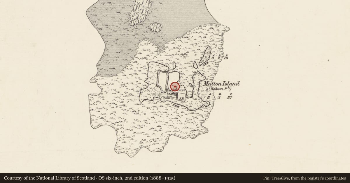
Mutton Island, County Galway, Ireland
The record
- Townland
- Mutton Island
- County
- Galway
- Country
- Ireland
- First-edition OS map
- Not indicated
- Latest-edition OS map
- Not indicated
- Coordinates
- 53.25441, -9.05358
- SMR number
- GA094-032----
Slide toward Today to fade the historical sheet and see the modern map underneath.
David Rumsey Map Collection, Stanford LibrariesDavid Rumsey Map Collection, Stanford LibrariesDavid Rumsey Map Collection, Stanford LibrariesDavid Rumsey Map Collection, Stanford Libraries
4 historical maps cover this location, the earliest the 1753 map "Mappa geographica Regni Hiberniae" (David Rumsey Map Collection, Stanford Libraries).
Historical maps covering this location
- 1753 · Mappa geographica Regni Hiberniae (David Rumsey Map Collection, Stanford Libraries)
- 1790 · Composite: Ireland. (David Rumsey Map Collection, Stanford Libraries)
- 1869 · Ireland. (David Rumsey Map Collection, Stanford Libraries)
- 1891 · Ireland 16 (David Rumsey Map Collection, Stanford Libraries)
This record in the National Monuments Service's Historic Environment Viewer ↗
The National Monuments Service's description
On Mutton Island, a low irregular offshore island 2km S of Galway town (GA094-100----). No visible surface trace survives but the fortifications may have been quite extensive: the island's shape bears a remarkable resemblance to a star-shaped fort. An artillery battery was constructed here as early as 1611 and a report of 1691 considered Mutton Island, 'where the old castle stoud', as the best place for the construction of a fort (Walsh 1981, 70, 115). Whether it was ever built is unclear; in 1691 Goubet drew a plan of the (?proposed) fortifications (NLI MS 2742; pers. comm. P. Walsh). The island was subsequently re-fortified as a battery in 1702 and again in the mid-18th C (Walsh 1981, 118, 128). Demolished in 1815 to make way for the lighthouse. (Kerrigan 1980, 136; Hardiman 1820, 164-5, 167, 316-17)
The above description is derived from the published 'Archaeological Inventory of County Galway Vol. I - West Galway'. Compiled by Paul Gosling (Dublin: Stationery Office, 1993).
Date of upload: 05 August 2010
Nearby in the register
- Monumental structureunder 1 mi
- Monumental structureunder 1 mi
- Monumental structureunder 1 mi
- Fortificationunder 1 mi
Other entries of the same register within about three miles of this one, by straight line.