Sites and Monuments Record · Ireland
Ecclesiastical enclosure
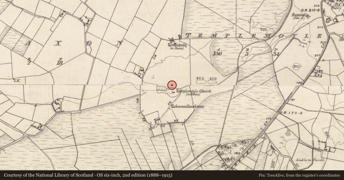
Templemoyle (Graigabbey ED), County Galway, Ireland
The record
- Townland
- Templemoyle (Graigabbey ED)
- County
- Galway
- Country
- Ireland
- First-edition OS map
- Not indicated
- Latest-edition OS map
- Not indicated
- Coordinates
- 53.33905, -8.69435
- SMR number
- GA084-127001-
Slide toward Today to fade the historical sheet and see the modern map underneath.
David Rumsey Map Collection, Stanford LibrariesDavid Rumsey Map Collection, Stanford LibrariesDavid Rumsey Map Collection, Stanford LibrariesDavid Rumsey Map Collection, Stanford Libraries
4 historical maps cover this location, the earliest the 1753 map "Mappa geographica Regni Hiberniae" (David Rumsey Map Collection, Stanford Libraries).
Historical maps covering this location
- 1753 · Mappa geographica Regni Hiberniae (David Rumsey Map Collection, Stanford Libraries)
- 1790 · Composite: Ireland. (David Rumsey Map Collection, Stanford Libraries)
- 1869 · Ireland. (David Rumsey Map Collection, Stanford Libraries)
- 1891 · Ireland 16 (David Rumsey Map Collection, Stanford Libraries)
This record in the National Monuments Service's Historic Environment Viewer ↗
The National Monuments Service's description
On the summit of a low rise overlooking a large bog to SW. It consists of a subcircular enclosure, possibly multivallate, surrounding church (GA084-127002-). The line of the outer enclosure (WNW-ESE 280m) is indicated on 3rd ed. of OS 6-inch map (1933) by field and td. boundaries curving from SE through S to WNW. Aerial reconnaissance in July 1971 (CUCAP BGI 35) shows a possible earthen bank along the line of this enclosure from SW to W. The aerial photograph also revealed the presence of a middle enclosure (ENE-WSW c. 150m), represented by an earthen scarp curving from E through S to SW. A number of subdivisions and a series of cultivation ridges are visible internally, particularly in the area immediately S of the modern graveyard. The latter has a notably curved SE boundary wall, possibly representing the line of a third inner enclosure immediately around the church. The church itself appears to be roughly centrally placed within both it and the middle enclosure. A holy well (GA087-127004-) lies 80m to SSW of the church, in S part of the outer enclosure, and a burial ground (GA071-082----) c. 100m to NE, just outside it. Another church (GA071-082003-) stands 265m to N. This monument also extends on to OS sheet 71 (GA071-082004-).
The above description is derived from the published 'Archaeological Inventory of County Galway Vol. II - North Galway'. Compiled by Olive Alcock, Kathy de hÓra and Paul Gosling (Dublin: Stationery Office, 1999).
See also: J. Mannion, Tech Saxon. 'An Anglo-Saxon monastic settlement in early medieval east Galway.' Journal of the Galway Archaeological and Historical Society 60(2008), 9-21.
Date of upload/revision: 01 July 2014
Nearby in the register
- Graveyardunder 1 mi
- Churchunder 1 mi
- Ritual site - holy wellunder 1 mi
- Burial groundunder 1 mi
Other entries of the same register within about three miles of this one, by straight line.