Sites and Monuments Record · Ireland
House - 17th century
Terryland, County Galway, Ireland
The record
- Townland
- Terryland
- County
- Galway
- Country
- Ireland
- First-edition OS map
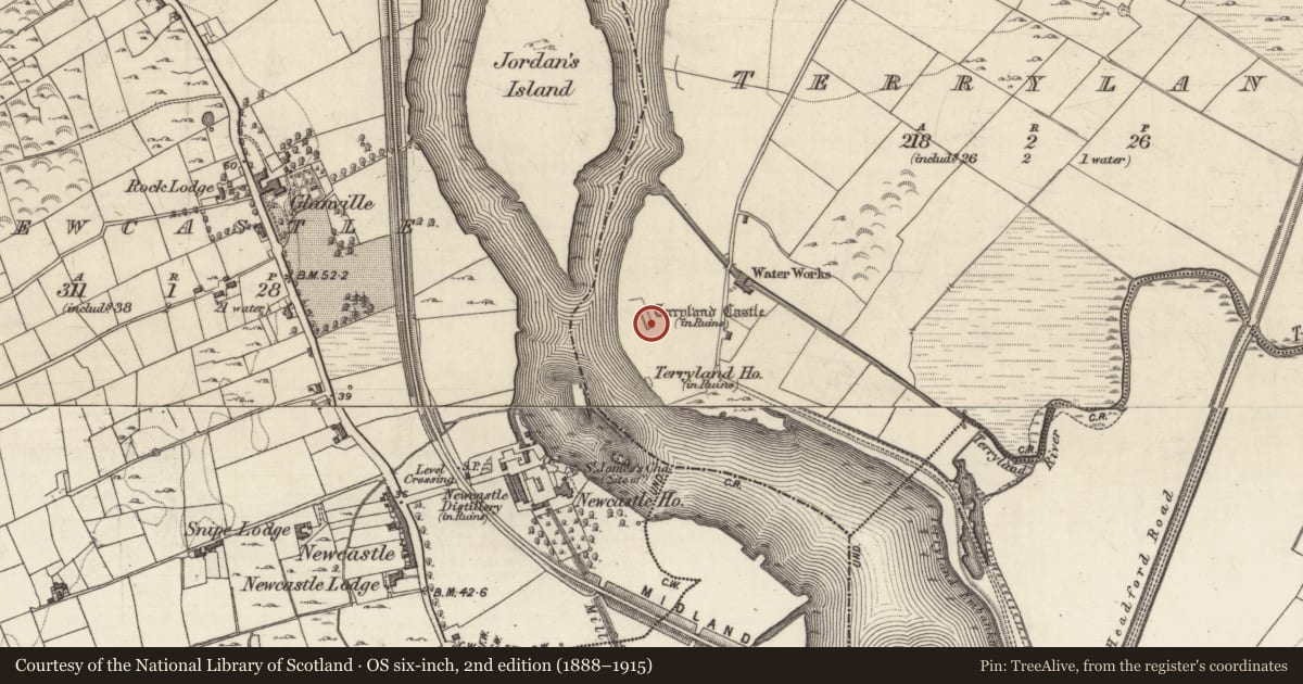
- Terryland Castle (in ruins)
- Latest-edition OS map
- Terryland Castle
- Coordinates
- 53.28306, -9.05950
- SMR number
- GA082-080002-
Slide toward Today to fade the historical sheet and see the modern map underneath.
David Rumsey Map Collection, Stanford LibrariesDavid Rumsey Map Collection, Stanford LibrariesDavid Rumsey Map Collection, Stanford LibrariesDavid Rumsey Map Collection, Stanford Libraries
4 historical maps cover this location, the earliest the 1753 map "Mappa geographica Regni Hiberniae" (David Rumsey Map Collection, Stanford Libraries).
Historical maps covering this location
- 1753 · Mappa geographica Regni Hiberniae (David Rumsey Map Collection, Stanford Libraries)
- 1790 · Composite: Ireland. (David Rumsey Map Collection, Stanford Libraries)
- 1869 · Ireland. (David Rumsey Map Collection, Stanford Libraries)
- 1891 · Ireland 16 (David Rumsey Map Collection, Stanford Libraries)
This record in the National Monuments Service's Historic Environment Viewer ↗
The National Monuments Service's description
On E bank of River Corrib, probably on the site of an earlier castle (GA082-080001-). Fragmentary ruins of a roughly rectangular two-storey 17th-C house (L 24.45m, Wth c. 10.5m ext.), in local authority care. Most of S end is now reduced to foundations but an enigmatic offset in the line of W wall suggests that more than one phase of construction may have been involved. The N gable, steeply pitched and crowned by three fine diamond chimneys, is intact, as is N end of W wall. The latter contains a doorway flanked by four twin-lighted mullioned windows with hood-mouldings, arranged in two storeys. Traces of two or more windows of a gabled attic survive above these, and the corbels of angle bartizans are visible on NE and NW corners at the same level. There are fireplaces in N and E walls and an oven in NE corner on ground floor. (Fahey 1901c, 315; Leask 1977, 156-7)
The above description is derived from the published 'Archaeological Inventory of County Galway Vol. I - West Galway'. Compiled by Paul Gosling (Dublin: Stationery Office, 1993).
Date of upload: 09 August 2010
Nearby in the register
- Castle - unclassifiedunder 1 mi
- House - 18th/19th centuryunder 1 mi
- Churchunder 1 mi
- Quarryunder 1 mi
Other entries of the same register within about three miles of this one, by straight line.