Sites and Monuments Record · Ireland
Cross-slab
Cruach Na Cara, County Galway, Ireland
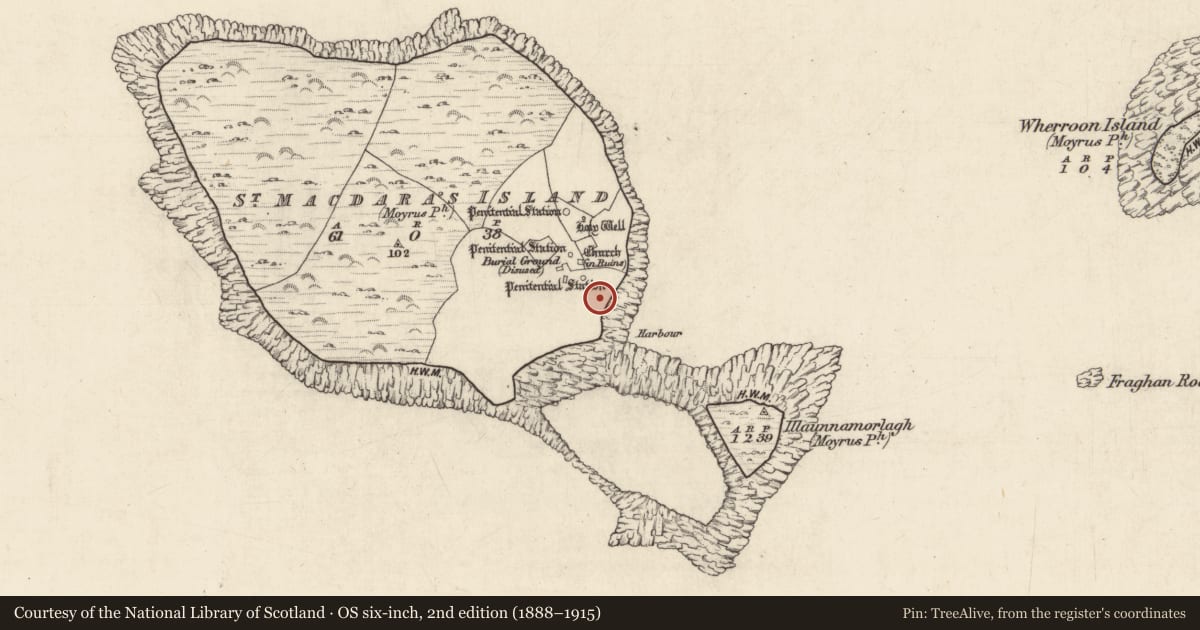
The record
- Townland
- Cruach Na Cara
- County
- Galway
- Country
- Ireland
- First-edition OS map
- Not indicated
- Latest-edition OS map
- Not indicated
- Coordinates
- 53.30410, -9.91691
- SMR number
- GA076-020007-
Slide toward Today to fade the historical sheet and see the modern map underneath.
David Rumsey Map Collection, Stanford LibrariesDavid Rumsey Map Collection, Stanford LibrariesDavid Rumsey Map Collection, Stanford LibrariesDavid Rumsey Map Collection, Stanford Libraries
4 historical maps cover this location, the earliest the 1753 map "Mappa geographica Regni Hiberniae" (David Rumsey Map Collection, Stanford Libraries).
Historical maps covering this location
- 1753 · Mappa geographica Regni Hiberniae (David Rumsey Map Collection, Stanford Libraries)
- 1790 · Composite: Ireland. (David Rumsey Map Collection, Stanford Libraries)
- 1869 · Ireland. (David Rumsey Map Collection, Stanford Libraries)
- 1891 · Ireland 16 (David Rumsey Map Collection, Stanford Libraries)
This record in the National Monuments Service's Historic Environment Viewer ↗
The National Monuments Service's description
Located just above the landing place at Cruach na Cara/St Macdara’s Island, this granite cross-slab (H 0.98m; Wth 0.46m) is beautifully decorated on both faces. Described by Higgins (1987, ii, 348-9, no. 72) as a pillar that has been worked to look vaguely cruciform, short stubby arms project slightly from the sides. The E face bears a large outline Latin cross in false relief with prominent T-shaped terminals. The base terminates in a pair of opposed angular spirals. A roundel is visible at the junction of the arms and shaft and there is a small boss with a central hollow in each of the two upper cantons. Possible conjoined boss-like features are evident in the lower cantons.
The W face bears another Latin cross in false relief that is enclosed in a broken semicircular band. The cross forms an openwork pattern and has subrectangular terminals with two ‘steps’ beneath each arm. There is a rectilinear recess at the junction of the arms and shaft and it contains a boss with a central hollow. Conjoined bosses, similar to those on the E face, are visible in the lower cantons. A large triquetra knot is visible below the cross. Another recumbent cross-slab (GA076-020001-) is visible 6m to the N. (Bigger 1896, 109-110; Crawford 1907, 212, 218)
Compiled by: Olive Alcock
Date of upload: 6 June 2018
References
Higgins, J.G. 1987 The Early Christian cross slabs, pillar stones and related monuments of County Galway, Ireland, 2 vols. British Archaeological Reports, International Series 375. Oxford.
Bigger, F.J. 1896 Cruach Mac Dara, off the coast of Connamara: with a notice of its church, crosses, and antiquities. Journal of the Royal Society of Antiquaries of Ireland 26, 101-12.
Crawford, H.S. 1907 A descriptive list of early Irish crosses. Journal of the Royal Society of Antiquaries of Ireland 37, 187-239; 43, 151-69, 261-65, 326-34.
Nearby in the register
- Cross-slabunder 1 mi
- Burialunder 1 mi
- Middenunder 1 mi
- Burialunder 1 mi
Other entries of the same register within about three miles of this one, by straight line.