Sites and Monuments Record · Ireland
Castle - tower house
Monivea Demesne, County Galway, Ireland
The record
- Townland
- Monivea Demesne
- County
- Galway
- Country
- Ireland
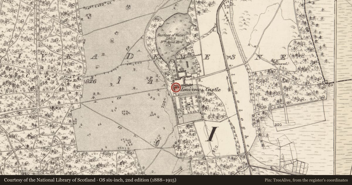
- First-edition OS map
- Monivea Castle
- Latest-edition OS map
- Monivea Castle
- Coordinates
- 53.37631, -8.67827
- SMR number
- GA071-064001-
Slide toward Today to fade the historical sheet and see the modern map underneath.
David Rumsey Map Collection, Stanford LibrariesDavid Rumsey Map Collection, Stanford LibrariesDavid Rumsey Map Collection, Stanford LibrariesDavid Rumsey Map Collection, Stanford Libraries
4 historical maps cover this location, the earliest the 1753 map "Mappa geographica Regni Hiberniae" (David Rumsey Map Collection, Stanford Libraries).
Historical maps covering this location
- 1753 · Mappa geographica Regni Hiberniae (David Rumsey Map Collection, Stanford Libraries)
- 1790 · Composite: Ireland. (David Rumsey Map Collection, Stanford Libraries)
- 1869 · Ireland. (David Rumsey Map Collection, Stanford Libraries)
- 1891 · Ireland 16 (David Rumsey Map Collection, Stanford Libraries)
This record in the National Monuments Service's Historic Environment Viewer ↗
The National Monuments Service's description
In flat pastureland, formerly demesne land. In existence before 1504 when it was 'destroyed' by 'Mac William De Burgo' (O'Flanagan 1927, Vol. 1, 236-7, 243) (see also GA059-037----). The 'Monivea Castle' marked on OS 6-inch maps was an 18-19th-C mansion, incorporating an original tower house, which was demolished c. 1940 (Bence-Jones 1978, 208). The standing remains comprise a much-altered late medieval rectangular tower (L 12.5m, Wth 9.5m) probably of three/four storeys, now inaccessible. The modern doorway in E wall is probably on the site of the original. Apart from one two-light flat-headed window on upper face of E wall, all the surviving opes appear to be of 18-19th-C date. The stepped parapets are also of similar date, and a number of chimney stacks are visible at roof level. (Nolan 1901b, 122)
The above description is derived from the published 'Archaeological Inventory of County Galway Vol. II - North Galway'. Compiled by Olive Alcock, Kathy de hÓra and Paul Gosling (Dublin: Stationery Office, 1999).
Date of upload: 05 August 2010
Nearby in the register
- Country houseunder 1 mi
- Icehouseunder 1 mi
- Mausoleumunder 1 mi
- Windmillunder 1 mi
Other entries of the same register within about three miles of this one, by straight line.