Sites and Monuments Record · Ireland
Castle - tower house
Ceathrú An Chaisleáin, County Galway, Ireland
The record
- Townland
- Ceathrú An Chaisleáin
- County
- Galway
- Country
- Ireland
- First-edition OS map
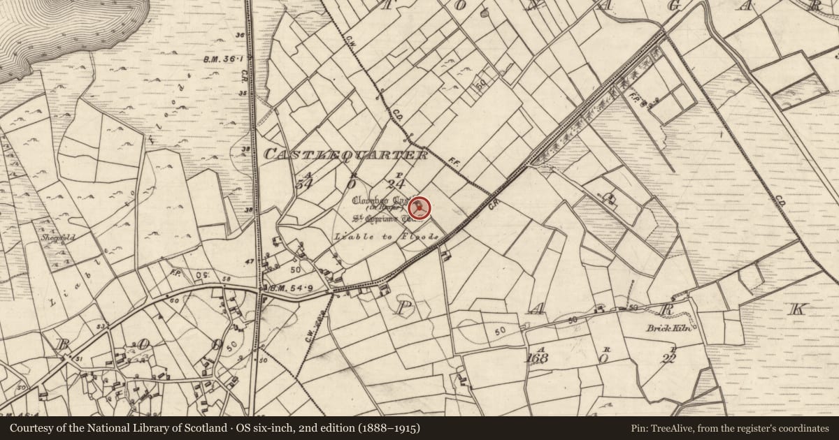
- Cloonboo Castle
- Latest-edition OS map
- Cloonboo Castle (in Ruins)
- Coordinates
- 53.37931, -9.01110
- SMR number
- GA069-013001-
Slide toward Today to fade the historical sheet and see the modern map underneath.
David Rumsey Map Collection, Stanford LibrariesDavid Rumsey Map Collection, Stanford LibrariesDavid Rumsey Map Collection, Stanford LibrariesDavid Rumsey Map Collection, Stanford Libraries
4 historical maps cover this location, the earliest the 1753 map "Mappa geographica Regni Hiberniae" (David Rumsey Map Collection, Stanford Libraries).
Historical maps covering this location
- 1753 · Mappa geographica Regni Hiberniae (David Rumsey Map Collection, Stanford Libraries)
- 1790 · Composite: Ireland. (David Rumsey Map Collection, Stanford Libraries)
- 1869 · Ireland. (David Rumsey Map Collection, Stanford Libraries)
- 1891 · Ireland 16 (David Rumsey Map Collection, Stanford Libraries)
This record in the National Monuments Service's Historic Environment Viewer ↗
The National Monuments Service's description
On a slight rise in low-lying marshy bogland. In existence in 1574 when it was in the possession of 'Moyler McShean' (Nolan 1901b, 118). A poorly preserved rectangular four-storey tower (L 12.3m, Wth 10.6m) heavily overgrown with ivy. Almost all the dressed stones have been removed and there is a breach in ENE wall. The robbed-out doorway in NNW wall leads to a small entrance lobby with a murder-hole above. A short intramural stairs to S leads to the spiral staircase. A stone vault exists between ground/1st floor. The garderobe is in ENE wall on 1st floor. Intramural chambers occur in NNW and SSE walls on 2nd floor. A fireplace survives in SSE wall on 1st floor and its flue is visible within a window embrasure overhead on 2nd floor. Projecting corbels on top of NNW wall, over the doorway, indicate the former presence of a machiolation. Some slit and flat-headed rectangular windows survive. There is a holy well (GA069-013002-) c. 40m to SE, while 30m to E is a possible moated site (GA069-013003-). (Nolan 1901a, 44)
The above description is derived from the published 'Archaeological Inventory of County Galway Vol. II - North Galway'. Compiled by Olive Alcock, Kathy de hÓra and Paul Gosling (Dublin: Stationery Office, 1999).
Date of upload: 05 August 2010
Nearby in the register
- Ritual site - holy wellunder 1 mi
- Enclosureunder 1 mi
- Cistunder 1 mi
- House - vernacular houseunder 1 mi
Other entries of the same register within about three miles of this one, by straight line.