Sites and Monuments Record · Ireland
Chapel
Moneen (Part of), County Galway, Ireland
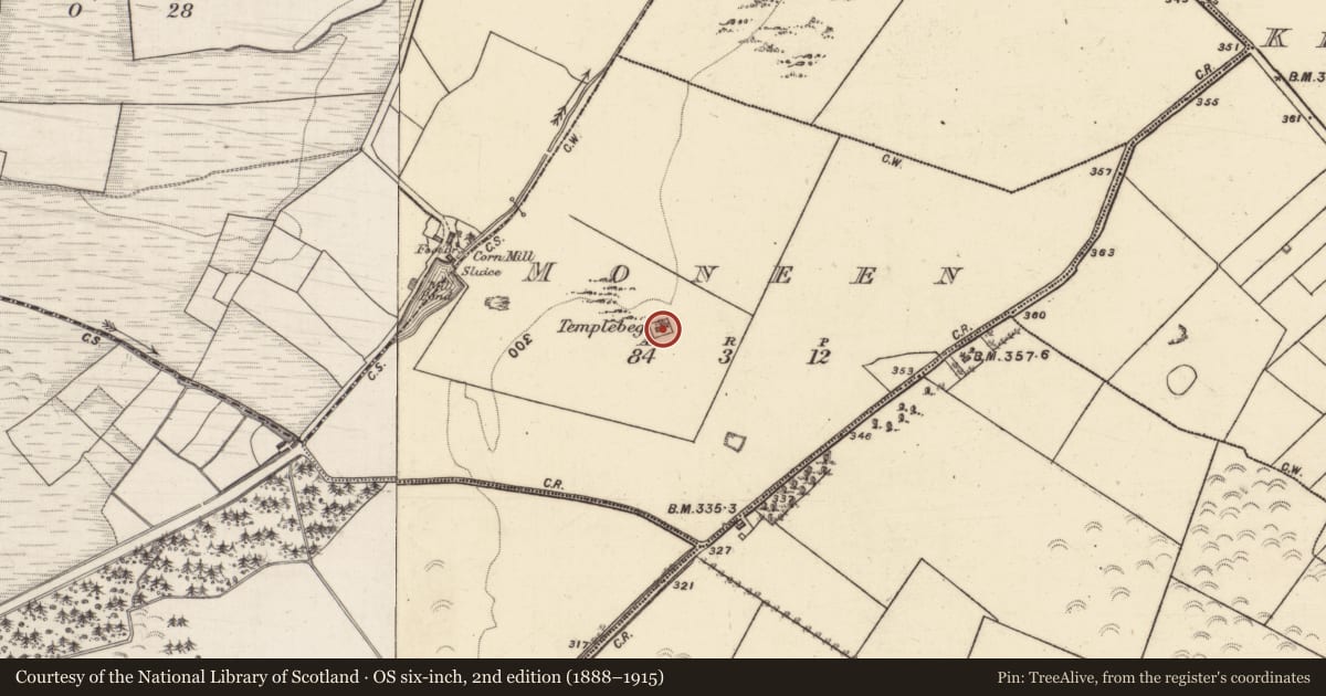
The record
- Townland
- Moneen (Part of)
- County
- Galway
- Country
- Ireland
- First-edition OS map
- NULL
- Latest-edition OS map
- Templebeg
- Coordinates
- 53.41227, -8.51449
- SMR number
- GA060-176----
Slide toward Today to fade the historical sheet and see the modern map underneath.
David Rumsey Map Collection, Stanford LibrariesDavid Rumsey Map Collection, Stanford LibrariesDavid Rumsey Map Collection, Stanford LibrariesDavid Rumsey Map Collection, Stanford Libraries
4 historical maps cover this location, the earliest the 1753 map "Mappa geographica Regni Hiberniae" (David Rumsey Map Collection, Stanford Libraries).
Historical maps covering this location
- 1753 · Mappa geographica Regni Hiberniae (David Rumsey Map Collection, Stanford Libraries)
- 1790 · Composite: Ireland. (David Rumsey Map Collection, Stanford Libraries)
- 1869 · Ireland. (David Rumsey Map Collection, Stanford Libraries)
- 1891 · Ireland 16 (David Rumsey Map Collection, Stanford Libraries)
This record in the National Monuments Service's Historic Environment Viewer ↗
The National Monuments Service's description
On a low hillock, it is enclosed by a rectangular wall but no trace of a graveyard is visible. It comprises a small well-preserved rectangular building (E-W; L 8.9m, Wth 5.25m ext.), complete with a slated roof and cross on E gable. There is a trabeate doorway in W gable which has chamfered jambs externally. This is surmounted by a plaque bearing the crest of the Blake family, dated 1688. There is also a narrow single-light flat-headed window in E gable: externally its jambs are chamfered and there are traces of a moulding around the sill. The exterior and interior are plastered and the latter is roofed by a vaulted ceiling. The interior contains a burial vault of the Blake family and a number of architectural fragments. Possibly an early oratory refurbished as a mortuary chapel: according to local tradition, mass was celebrated here in Penal times. An enclosure (GA060-177----) lies c. 100m to SW.
The above description is derived from the published 'Archaeological Inventory of County Galway Vol. II - North Galway'. Compiled by Olive Alcock, Kathy de hÓra and Paul Gosling (Dublin: Stationery Office, 1999).
Date of upload: 05 August 2010
Nearby in the register
- Enclosureunder 1 mi
- Mill - cornunder 1 mi
- Quarryunder 1 mi
- Mass-rockunder 1 mi
Other entries of the same register within about three miles of this one, by straight line.