Sites and Monuments Record · Ireland
Cairn - unclassified
Glennaveel, County Galway, Ireland
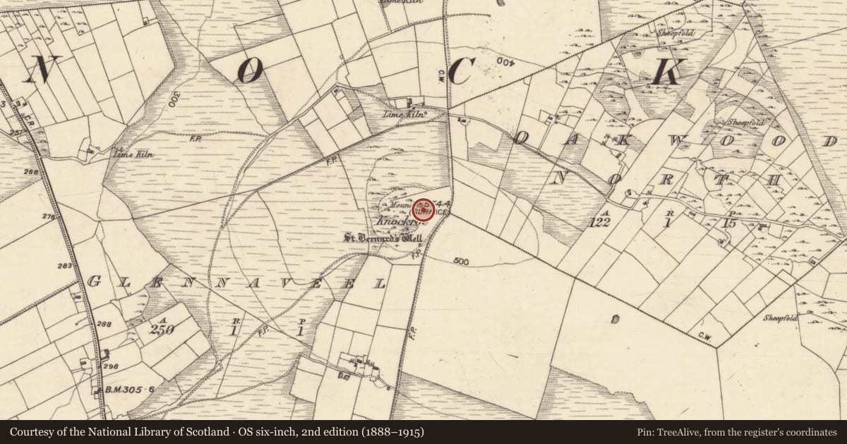
The record
- Townland
- Glennaveel
- County
- Galway
- Country
- Ireland
- First-edition OS map
- Not indicated
- Latest-edition OS map
- Mound
- Coordinates
- 53.42005, -8.74218
- SMR number
- GA058-061----
Slide toward Today to fade the historical sheet and see the modern map underneath.
David Rumsey Map Collection, Stanford LibrariesDavid Rumsey Map Collection, Stanford LibrariesDavid Rumsey Map Collection, Stanford LibrariesDavid Rumsey Map Collection, Stanford Libraries
4 historical maps cover this location, the earliest the 1753 map "Mappa geographica Regni Hiberniae" (David Rumsey Map Collection, Stanford Libraries).
Historical maps covering this location
- 1753 · Mappa geographica Regni Hiberniae (David Rumsey Map Collection, Stanford Libraries)
- 1790 · Composite: Ireland. (David Rumsey Map Collection, Stanford Libraries)
- 1869 · Ireland. (David Rumsey Map Collection, Stanford Libraries)
- 1891 · Ireland 16 (David Rumsey Map Collection, Stanford Libraries)
This record in the National Monuments Service's Historic Environment Viewer ↗
The National Monuments Service's description
On the summit of Knockroe, a prominent partly wooded hill to SW of Abbeyknockmoy. A total of three small cairns are visible, all denuded and/or partly damaged by the relay stations on the hill summit: (a GA058-061----) the largest cairn on the highest point (OD 554 ft), is circular (D 12m) and was previously used as a trigonometrical point; (b GA058-061001-) c. 12m to S is another circular cairn (D 9m, H 1.6m) surmounted by the modern concrete trigonometrical station; (c GA058-061002-) c. 14m to NE of (a) is another small circular cairn (D 5m, H 0.5m).
The above description is derived from the published 'Archaeological Inventory of County Galway Vol. II - North Galway'. Compiled by Olive Alcock, Kathy de hÓra and Paul Gosling (Dublin: Stationery Office, 1999).
Date of upload: 05 August 2010
Nearby in the register
- Cairn - unclassifiedunder 1 mi
- Cairn - unclassifiedunder 1 mi
- Ritual site - holy wellunder 1 mi
- Ritual site - holy wellunder 1 mi
Other entries of the same register within about three miles of this one, by straight line.