Sites and Monuments Record · Ireland
Road - road/trackway
Corrofin, County Galway, Ireland
The record
- Townland
- Corrofin
- County
- Galway
- Country
- Ireland
- First-edition OS map
- Not indicated
- Latest-edition OS map
- Not indicated
- Coordinates
- 53.43580, -8.86501
- SMR number
- GA057-161----
Slide toward Today to fade the historical sheet and see the modern map underneath.
David Rumsey Map Collection, Stanford LibrariesDavid Rumsey Map Collection, Stanford LibrariesDavid Rumsey Map Collection, Stanford LibrariesDavid Rumsey Map Collection, Stanford Libraries
4 historical maps cover this location, the earliest the 1753 map "Mappa geographica Regni Hiberniae" (David Rumsey Map Collection, Stanford Libraries).
Historical maps covering this location
- 1753 · Mappa geographica Regni Hiberniae (David Rumsey Map Collection, Stanford Libraries)
- 1790 · Composite: Ireland. (David Rumsey Map Collection, Stanford Libraries)
- 1869 · Ireland. (David Rumsey Map Collection, Stanford Libraries)
- 1891 · Ireland 16 (David Rumsey Map Collection, Stanford Libraries)
This record in the National Monuments Service's Historic Environment Viewer ↗
The National Monuments Service's description
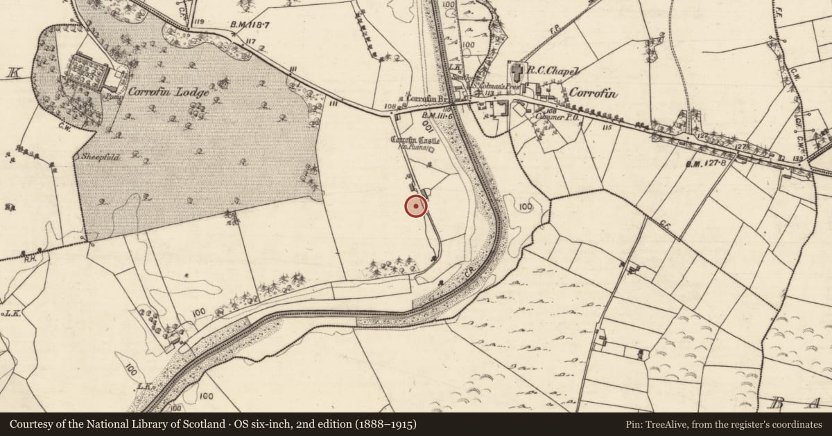
On W bank of the River Clare a short distance S of Corrofin Castle (GA057-089----). Aerial reconnaissance in July 1970 (CUCAP BDN 77) showed a section of an old roadway (L c. 60m) immediately SW of the building marked 'Corofin Lodge' on 3rd ed. of OS 6-inch map (1933). This comprised a slightly raised linear earthwork defined by two low parallel banks. It followed a NE-SW axis but appeared to turn W at its SW end, where its line could be traced for a further c. 100m as a faint ridge and cropmark. At its NE end, its NE-SW axis is continued by a field boundary for a further c. 75m. Its presence suggests that there was an older crossing point c. 100m downstream from the present bridge (GA057-091----), probably at the point where 1st ed. of OS 6-inch map shows a weir. Not visited.
The above description is derived from the published 'Archaeological Inventory of County Galway Vol. II - North Galway'. Compiled by Olive Alcock, Kathy de hÓra and Paul Gosling (Dublin: Stationery Office, 1999).
Date of upload: 05 August 2010
Nearby in the register
- Burial groundunder 1 mi
- Castle - tower houseunder 1 mi
- Bridgeunder 1 mi
- Enclosureunder 1 mi
Other entries of the same register within about three miles of this one, by straight line.