Sites and Monuments Record · Ireland
Castle - unclassified
Cahermorris, County Galway, Ireland
The record
- Townland
- Cahermorris
- County
- Galway
- Country
- Ireland
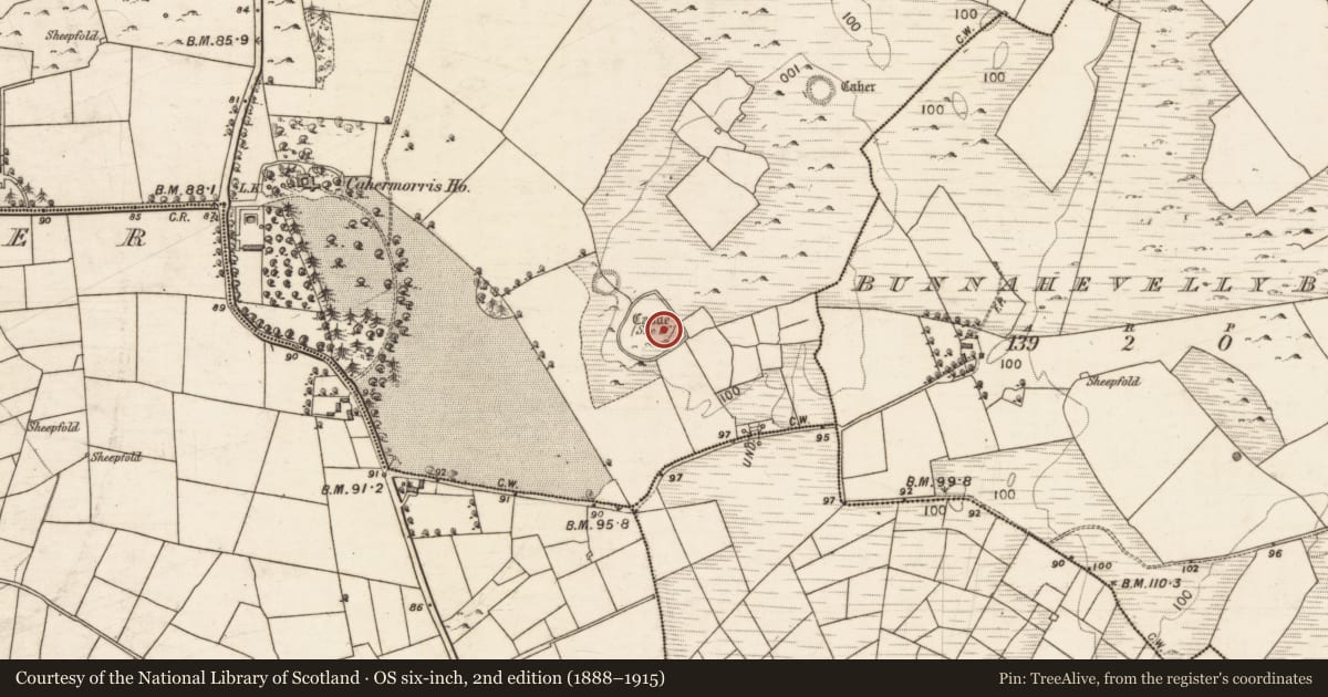
- First-edition OS map
- Site of Castle
- Latest-edition OS map
- Castle (Site of)
- Coordinates
- 53.42821, -8.99064
- SMR number
- GA056-043002-
Slide toward Today to fade the historical sheet and see the modern map underneath.
David Rumsey Map Collection, Stanford LibrariesDavid Rumsey Map Collection, Stanford LibrariesDavid Rumsey Map Collection, Stanford LibrariesDavid Rumsey Map Collection, Stanford Libraries
4 historical maps cover this location, the earliest the 1753 map "Mappa geographica Regni Hiberniae" (David Rumsey Map Collection, Stanford Libraries).
Historical maps covering this location
- 1753 · Mappa geographica Regni Hiberniae (David Rumsey Map Collection, Stanford Libraries)
- 1790 · Composite: Ireland. (David Rumsey Map Collection, Stanford Libraries)
- 1869 · Ireland. (David Rumsey Map Collection, Stanford Libraries)
- 1891 · Ireland 16 (David Rumsey Map Collection, Stanford Libraries)
This record in the National Monuments Service's Historic Environment Viewer ↗
The National Monuments Service's description
Within a large enclosure (GA056-043001-). According to Nolan (1901a, 46), it was in existence in 1570 when it 'belonged to Burke of Castle Hackett': in 1574 it is listed as being in the possession of 'Mc Walters sept' (ibid. 1901b, 118). Named but not indicated on 1st ed. of OS 6-inch map: on 3rd ed. (1920), its site is marked in E sector of the enclosure. No visible surface trace survives in this area but there is a low circular stony mound (D 8m) in N sector in which large chunks of masonry are visible. Within it is a roughly rectangular hollow (N-S 3.5m, E-W 1.5m) in which faint traces of wall-faces are visible. Though it lies inside the line of the enclosure wall, this may be synonymous with the 'slight trace of a mortar-built gateway' mentioned by Westropp (1919, 182-3, 168).
The above description is derived from the published 'Archaeological Inventory of County Galway Vol. II - North Galway'. Compiled by Olive Alcock, Kathy de hÓra and Paul Gosling (Dublin: Stationery Office, 1999).
Date of upload: 05 August 2010
This monument is subject to a preservation order made under the National Monuments Acts 1930 to 2014 (PO no. 1/1991).
Nearby in the register
- Enclosure - large enclosureunder 1 mi
- Ringfort - cashelunder 1 mi
- Ringfort - cashelunder 1 mi
- Souterrainunder 1 mi
Other entries of the same register within about three miles of this one, by straight line.