Sites and Monuments Record · Ireland
Graveyard
Inis Ní, County Galway, Ireland
The record
- Townland
- Inis Ní
- County
- Galway
- Country
- Ireland
- First-edition OS map
- Grave Yard
- Latest-edition OS map
- Grave Yard
- Coordinates
- 53.39611, -9.89245
- SMR number
- GA050-011002-
Slide toward Today to fade the historical sheet and see the modern map underneath.
David Rumsey Map Collection, Stanford LibrariesDavid Rumsey Map Collection, Stanford LibrariesDavid Rumsey Map Collection, Stanford LibrariesDavid Rumsey Map Collection, Stanford Libraries
4 historical maps cover this location, the earliest the 1753 map "Mappa geographica Regni Hiberniae" (David Rumsey Map Collection, Stanford Libraries).
Historical maps covering this location
- 1753 · Mappa geographica Regni Hiberniae (David Rumsey Map Collection, Stanford Libraries)
- 1790 · Composite: Ireland. (David Rumsey Map Collection, Stanford Libraries)
- 1869 · Ireland. (David Rumsey Map Collection, Stanford Libraries)
- 1891 · Ireland 16 (David Rumsey Map Collection, Stanford Libraries)
This record in the National Monuments Service's Historic Environment Viewer ↗
The National Monuments Service's description
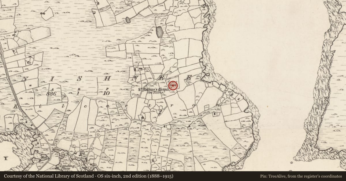
On the E side of Inis Ní, overlooking Cloonile Bay. Marked on the 1838 edition of the OS 6-inch map as a roughly subcircular graveyard (c. 30m NE-SW; c. 27m NE-SW) with a ‘St. Mathias’s Chapel’ (GA050-011001-) immediately outside its boundary at WSW. On the 1898-9 resurvey of the map both elements are incorporated into a larger graveyard, roughly trapezoidal in shape (c. 80m NE-SW; c. 77m NW-SE). Traces of the earlier burial area (40m N-S; 20m E-W), defined by a boundary wall constructed of large and small boulders, are visible in the E half of the graveyard in a slight hollow. It may mark the original monastic hermitage. The greatest concentration of burials occurs in its S half where rows of neat stone-lined graves with upright headstones are orientated E-W. A leacht (GA050-011003-) and its associated cross-inscribed pillar (GA050-011004-) are visible at SE. A low rough bolder wall divides this area and the N half is c. 1.5m lower. Fewer burials are visible in this section and they are of recent date.
Compiled by: Olive Alcock
Date of upload: 12 June 2018
Nearby in the register
- Leachtunder 1 mi
- Cross-inscribed pillarunder 1 mi
- Churchunder 1 mi
- Buildingunder 1 mi
Other entries of the same register within about three miles of this one, by straight line.