Sites and Monuments Record · Ireland
Chapel
Killian, County Galway, Ireland
The record
- Townland
- Killian
- County
- Galway
- Country
- Ireland
- First-edition OS map
- Not indicated
- Latest-edition OS map
- Not indicated
- Coordinates
- 53.49823, -8.40811
- SMR number
- GA046-050003-
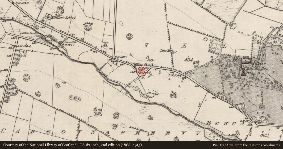
Slide toward Today to fade the historical sheet and see the modern map underneath.
David Rumsey Map Collection, Stanford LibrariesDavid Rumsey Map Collection, Stanford LibrariesDavid Rumsey Map Collection, Stanford LibrariesDavid Rumsey Map Collection, Stanford Libraries
4 historical maps cover this location, the earliest the 1790 map "Composite: Ireland." (David Rumsey Map Collection, Stanford Libraries).
Historical maps covering this location
- 1790 · Composite: Ireland. (David Rumsey Map Collection, Stanford Libraries)
- 1857 · Ireland (David Rumsey Map Collection, Stanford Libraries)
- 1869 · Ireland. (David Rumsey Map Collection, Stanford Libraries)
- 1891 · Ireland 16 (David Rumsey Map Collection, Stanford Libraries)
This record in the National Monuments Service's Historic Environment Viewer ↗
The National Monuments Service's description
On S slope of a hill in undulating grassland. According to local tradition, this was once the site of a 'monastery'. The visible remains comprise a triangular graveyard (E-W 110m, N-S 60m), bounded by a mortared stone wall, which is skirted along SE and SW sides by the county road. Within the graveyard are two structures: (a GA046-050002-) fragmentary remains of the church marked on OS 6-inch maps, probably a medieval parish church. This consists of a rectangular building (E-W; L >16.7m, Wth >6.8m) of which only the ivy-covered S wall still stands (Wth 1m, H 3.5m). A gap (Wth 1.4m) in the masonry towards its W end probably marks the site of the plain pointed arch doorway illustrated in OS Letters (O'Flanagan 1927, Vol. 1, 107-8). There are also traces of a broken single-light window towards E end of this wall. All that survives of E wall are some wall-footings, while nothing is visible of W or N walls. However, at W end of the building, there is a small overgrown rectangular structure (N-S 6.8m, E-W 4.7m), possibly a grave plot partly overlying the original walls. (b GA046-050003-) Close by to W, is a second, fairly well-preserved by ivy-covered, rectangular building (WNW-ESE; L 9.3m, Wth 5.4m), possibly a 17-18th-C chapel. There is a round-headed doorway in W wall, opposing aumbries in N and S walls, and a small flat-headed window in E wall. The latter is now blocked, partially by a modern concrete altar-like construction beneath it which is surmounted by a cross. This houses a fine coat of arms, possibly that of the Cheevers family of Killian House, some of whom are buried in the interior. A burial vault abuts W end of the external face of N wall of this building.
The above description is derived from the published 'Archaeological Inventory of County Galway Vol. II - North Galway'. Compiled by Olive Alcock, Kathy de hÓra and Paul Gosling (Dublin: Stationery Office, 1999).
Date of upload: 12 August 2016
Nearby in the register
- Churchunder 1 mi
- Ecclesiastical enclosureunder 1 mi
- Graveyardunder 1 mi
- Souterrainunder 1 mi
Other entries of the same register within about three miles of this one, by straight line.