Sites and Monuments Record · Ireland
House - indeterminate date
Carheens, County Galway, Ireland
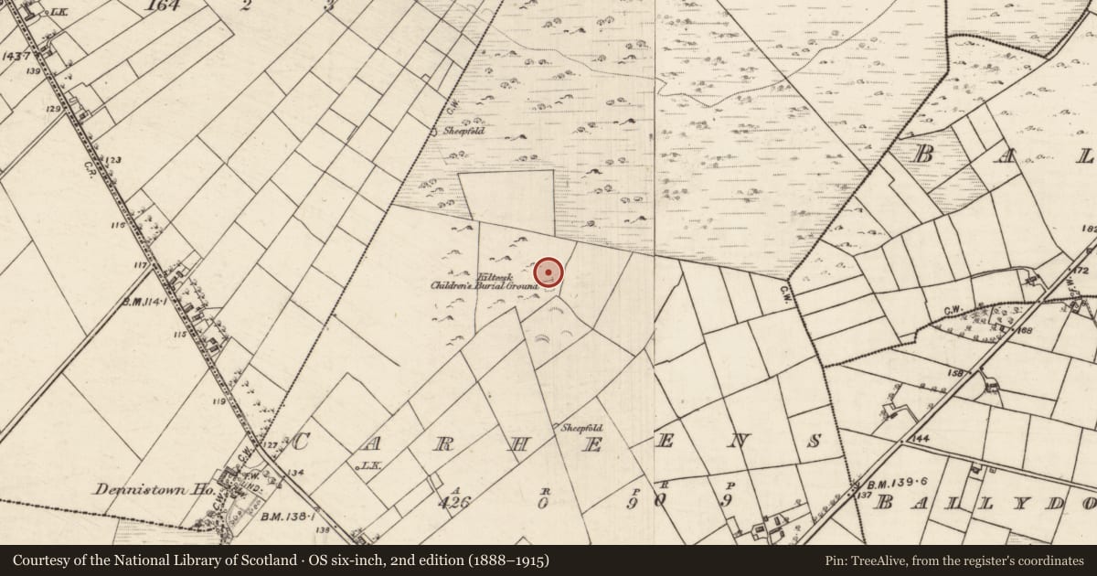
The record
- Townland
- Carheens
- County
- Galway
- Country
- Ireland
- First-edition OS map
- Not indicated
- Latest-edition OS map
- Not indicated
- Coordinates
- 53.47311, -8.96205
- SMR number
- GA042-076004-
Slide toward Today to fade the historical sheet and see the modern map underneath.
David Rumsey Map Collection, Stanford LibrariesDavid Rumsey Map Collection, Stanford LibrariesDavid Rumsey Map Collection, Stanford LibrariesDavid Rumsey Map Collection, Stanford Libraries
4 historical maps cover this location, the earliest the 1753 map "Mappa geographica Regni Hiberniae" (David Rumsey Map Collection, Stanford Libraries).
Historical maps covering this location
- 1753 · Mappa geographica Regni Hiberniae (David Rumsey Map Collection, Stanford Libraries)
- 1790 · Composite: Ireland. (David Rumsey Map Collection, Stanford Libraries)
- 1869 · Ireland. (David Rumsey Map Collection, Stanford Libraries)
- 1891 · Ireland 16 (David Rumsey Map Collection, Stanford Libraries)
This record in the National Monuments Service's Historic Environment Viewer ↗
The National Monuments Service's description
Associated with a large enclosure (GA042-076001-). A total of five houses were identified in and around the enclosure as follows: (a) close to the centre, a rectangular area (N-S; L 7.5m, Wth 3.5m) defined by a collapsed wall; (b) immediately to SE, a rectangular depression (N-S; L 5.9m, Wth 1.8m) defined by the foundations of a wall; (c) on the line of the enclosure wall at S, a rectangular area (NE-SW; L c. 8.6m, Wth 4.3m) defined by grassed-over rubble; (d) to NE of the enclosure, a partially sunken house, subcircular in plan (N-S; L 7.3, Wth 6.4m), defined by a bank revetted internally with a gap (Wth 1m) at E; (e) to SE of it, a poorly preserved rectangular house (N-S; L 5m, Wth 1.8m) defined by a low grassed-over stone wall.
The above description is derived from the published 'Archaeological Inventory of County Galway Vol. II - North Galway'. Compiled by Olive Alcock, Kathy de hÓra and Paul Gosling (Dublin: Stationery Office, 1999).
Date of upload: 05 August 2010
Nearby in the register
- Children's burial groundunder 1 mi
- Enclosureunder 1 mi
- House - indeterminate dateunder 1 mi
- House - indeterminate dateunder 1 mi
Other entries of the same register within about three miles of this one, by straight line.