Sites and Monuments Record · Ireland
Gatehouse
Ross (Clare By.), County Galway, Ireland
The record
- Townland
- Ross (Clare By.)
- County
- Galway
- Country
- Ireland
- First-edition OS map
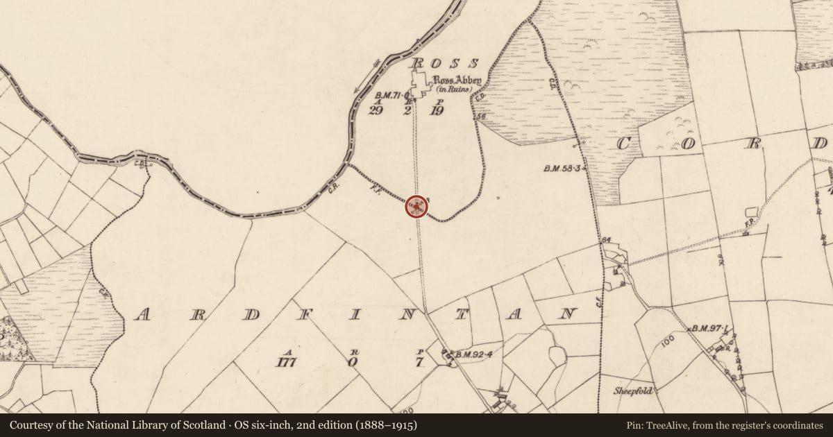
- Gateway (in ruins)
- Latest-edition OS map
- Not indicated
- Coordinates
- 53.47741, -9.13174
- SMR number
- GA041-047001-
Slide toward Today to fade the historical sheet and see the modern map underneath.
David Rumsey Map Collection, Stanford LibrariesDavid Rumsey Map Collection, Stanford LibrariesDavid Rumsey Map Collection, Stanford LibrariesDavid Rumsey Map Collection, Stanford Libraries
4 historical maps cover this location, the earliest the 1753 map "Mappa geographica Regni Hiberniae" (David Rumsey Map Collection, Stanford Libraries).
Historical maps covering this location
- 1753 · Mappa geographica Regni Hiberniae (David Rumsey Map Collection, Stanford Libraries)
- 1790 · Composite: Ireland. (David Rumsey Map Collection, Stanford Libraries)
- 1869 · Ireland. (David Rumsey Map Collection, Stanford Libraries)
- 1891 · Ireland 16 (David Rumsey Map Collection, Stanford Libraries)
This record in the National Monuments Service's Historic Environment Viewer ↗
The National Monuments Service's description
Some 218m S of Ross Errilly Friary (GA041-047----), on the line of a causeway (see GA041-047003-). Named 'Gateway (in ruins)' on the 1838 edition of the OS 6-inch map and depicted c. 80m to the N of its actual location. All that survives is a section of a mortared stone wall (L >9m, Wth 1.15m, H c. 3m), aligned SE-NW, in which the outlines of a number of blocked opes are visible. A modern wall abuts it at SE end. According to Fahey (1901, 335-6), this gateway was on the line of 'the enclosing wall and ditch which surrounded the … monastery' (see GA041-047004-).
The above description is derived from the published 'Archaeological Inventory of County Galway Vol. II - North Galway'. Compiled by Olive Alcock, Kathy de hÓra and Paul Gosling (Dublin: Stationery Office, 1999). In certain instances the entries have been revised and updated in the light of recent research.
Updated by: Olive Alcock
Date of revised upload: 26 July 2018
References
Fahey, J. 1901c Proceedings: Galway excursion. Journal of the Royal Society of Antiquaries of Ireland 31, 305-40.
Nearby in the register
- Causewayunder 1 mi
- Crossunder 1 mi
- Wall monumentunder 1 mi
- Graveslabunder 1 mi
Other entries of the same register within about three miles of this one, by straight line.