Sites and Monuments Record · Ireland
Ritual site - holy well
St Brendan'S Or Cregganagrogy, County Galway, Ireland
The record
- Townland
- St Brendan'S Or Cregganagrogy
- County
- Galway
- Country
- Ireland
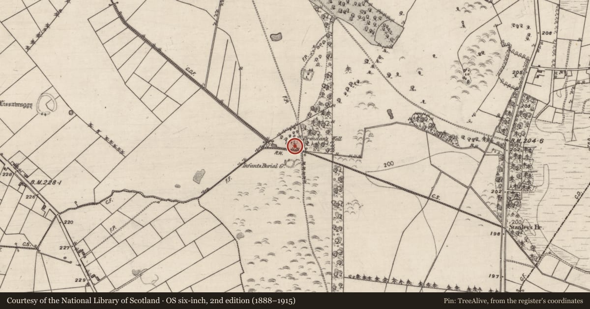
- First-edition OS map
- St. Brendans Grave and Well
- Latest-edition OS map
- St. Brendans Well
- Coordinates
- 53.52821, -8.39472
- SMR number
- GA032-043----
Slide toward Today to fade the historical sheet and see the modern map underneath.
David Rumsey Map Collection, Stanford LibrariesDavid Rumsey Map Collection, Stanford LibrariesDavid Rumsey Map Collection, Stanford LibrariesDavid Rumsey Map Collection, Stanford Libraries
4 historical maps cover this location, the earliest the 1790 map "Composite: Ireland." (David Rumsey Map Collection, Stanford Libraries).
Historical maps covering this location
- 1790 · Composite: Ireland. (David Rumsey Map Collection, Stanford Libraries)
- 1811 · Ireland. (David Rumsey Map Collection, Stanford Libraries)
- 1869 · Ireland. (David Rumsey Map Collection, Stanford Libraries)
- 1891 · Ireland 16 (David Rumsey Map Collection, Stanford Libraries)
This record in the National Monuments Service's Historic Environment Viewer ↗
The National Monuments Service's description
Some 50m N of a CBG (GA032-006----). Marked on 1st ed. of OS 6-inch map as 'St. Brendan's Grave and Well'.
On inspection in July 1984, two holy wells were recorded here: (a, GA032-043----) a natural spring, dried up at the time of visit, enclosed by a circular drystone wall (D 1.15m) with an entrance at W, and (b, GA032-043001-) 1m to S, another dried-up spring well enclosed by a square mortared wall (L/Wth 2.5m) with an entrance at SE. A stone-lined overflow channel ran beneath the entrance. The 3rd ed. of OS 6-inch map (1931) depicted a circular pathway surrounding the wells, no visible surface of it trace survived. Some 7m to the W, a 17/18th-C inscribed limestone slab (GA032-043002-), depicting a crucifixion, reputedly marked the grave of St Brendan. The wells and slab subsequently underwent some works up by a local group. (O'Flanagan 1927, Vol. 1, 108-9)
The above description is derived from the published 'Archaeological Inventory of County Galway Vol. II - North Galway'. Compiled by Olive Alcock, Kathy de hÓra and Paul Gosling (Dublin: Stationery Office, 1999).
Updated by: Olive Alcock
Date of revised upload: 26 June 2023
Nearby in the register
- Ritual site - holy wellunder 1 mi
- Headstoneunder 1 mi
- Children's burial groundunder 1 mi
- Quarryunder 1 mi
Other entries of the same register within about three miles of this one, by straight line.