Sites and Monuments Record · Ireland
Cathedral
Townparks (2nd Division - Tuam), County Galway, Ireland
The record
- Townland
- Townparks (2nd Division - Tuam)
- County
- Galway
- Country
- Ireland
- First-edition OS map
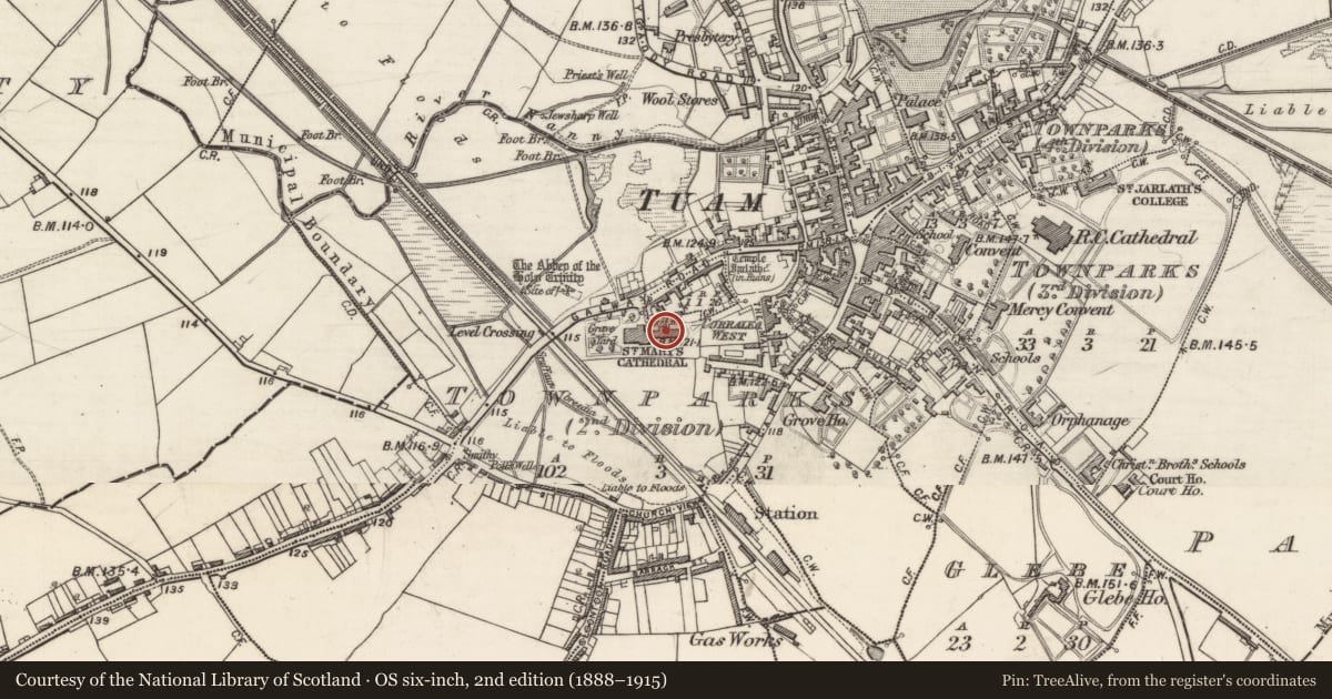
- St. Marys Cathedral
- Latest-edition OS map
- ST. MARYS CATHEDRAL
- Coordinates
- 53.51373, -8.85497
- SMR number
- GA029-179001-
Slide toward Today to fade the historical sheet and see the modern map underneath.
David Rumsey Map Collection, Stanford LibrariesDavid Rumsey Map Collection, Stanford LibrariesDavid Rumsey Map Collection, Stanford LibrariesDavid Rumsey Map Collection, Stanford Libraries
4 historical maps cover this location, the earliest the 1753 map "Mappa geographica Regni Hiberniae" (David Rumsey Map Collection, Stanford Libraries).
Historical maps covering this location
- 1753 · Mappa geographica Regni Hiberniae (David Rumsey Map Collection, Stanford Libraries)
- 1790 · Composite: Ireland. (David Rumsey Map Collection, Stanford Libraries)
- 1869 · Ireland. (David Rumsey Map Collection, Stanford Libraries)
- 1891 · Ireland 16 (David Rumsey Map Collection, Stanford Libraries)
This record in the National Monuments Service's Historic Environment Viewer ↗
The National Monuments Service's description
At S end of high St., in the centre of Tuam town (GA029-199----). It is now sandwiched between the 19th-C Protestant cathedral of St Mary and the 14th-C Synod Hall (GA029-179002-). A Romanesque nave and chancel church built in the late 12th C (Clyne 1988, 90). The nave was destroyed by fire in 1767 (ibid.) but the chancel, square in plan (L c. 5.5m), with its fine barrel-vaulted roof survives. This was subsequently used as a porch for the adjoining Synod Hall. A Nat. Mon., the surviving architectural features include an outstanding ornate Romanesque chancel arch of six orders supported by coulumns, three decorated round-headed Romanesque windows in E gable, and another in S wall (Leask 1977, 153-4). (Gwynn and Hadcock 1970, 98-100; Harbison 1975, 101-2; Stalley 1981)
The above description is derived from the published 'Archaeological Inventory of County Galway Vol. II - North Galway'. Compiled by Olive Alcock, Kathy de hÓra and Paul Gosling (Dublin: Stationery Office, 1999).
Date of upload: 05 August 2010
Nearby in the register
- Cathedralunder 1 mi
- Buildingunder 1 mi
- Burialunder 1 mi
- Cross - High crossunder 1 mi
Other entries of the same register within about three miles of this one, by straight line.