Sites and Monuments Record · Ireland
Penitential station
Ballygaddy, County Galway, Ireland
The record
- Townland
- Ballygaddy
- County
- Galway
- Country
- Ireland
- First-edition OS map
- NULL
- Latest-edition OS map
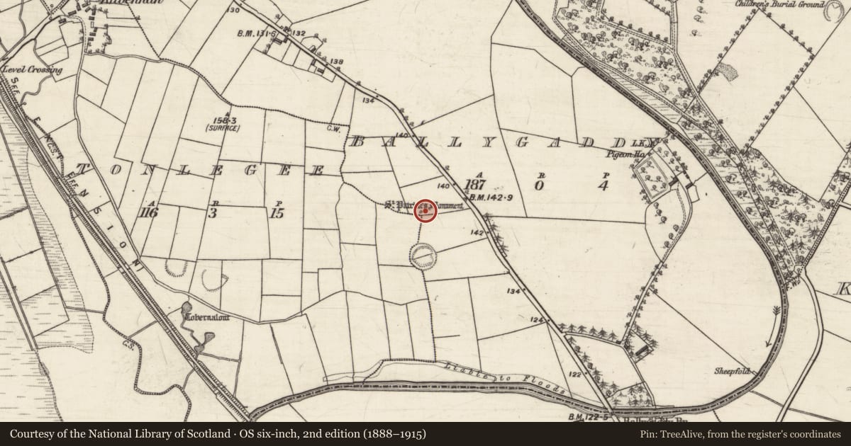
- St. Patricks Monument
- Coordinates
- 53.53458, -8.88135
- SMR number
- GA029-014----
Slide toward Today to fade the historical sheet and see the modern map underneath.
David Rumsey Map Collection, Stanford LibrariesDavid Rumsey Map Collection, Stanford LibrariesDavid Rumsey Map Collection, Stanford LibrariesDavid Rumsey Map Collection, Stanford Libraries
4 historical maps cover this location, the earliest the 1753 map "Mappa geographica Regni Hiberniae" (David Rumsey Map Collection, Stanford Libraries).
Historical maps covering this location
- 1753 · Mappa geographica Regni Hiberniae (David Rumsey Map Collection, Stanford Libraries)
- 1790 · Composite: Ireland. (David Rumsey Map Collection, Stanford Libraries)
- 1869 · Ireland. (David Rumsey Map Collection, Stanford Libraries)
- 1891 · Ireland 16 (David Rumsey Map Collection, Stanford Libraries)
This record in the National Monuments Service's Historic Environment Viewer ↗
The National Monuments Service's description
Close to the td. boundary in level reclaimed pastureland. Named in OS Letters (O'Flanagan 1927, Vol. 1, 15, 90-91) as 'Leacht Phadruig' and described as 'consisting of two heaps of stones of which the southern one has a small rude fixture, representing an altar ... called Altoir Pharraig [sic]'. Kelly (1901, 384) noted that 'the impression of his knees [are pointed out] in the hollowed stone'. These are presumably synonymous with the 'two spots bare of grass' noted by Killanin and Duignan (1967, 448). The site is now enclosed by a modern hexagonal concrete wall which was built in 1933. It is surmounted by a wrought iron cross at E. There is a stile at W but the densely overgrown interior masks all, and none of the features noted above were located. Probably associated with the early ecclesiastical remains at Kilbenan (see GA029-017004-), 800m to NW. A ringfort (GA029-015----) lies 60m to S.
The above description is derived from the published 'Archaeological Inventory of County Galway Vol. II - North Galway'. Compiled by Olive Alcock, Kathy de hÓra and Paul Gosling (Dublin: Stationery Office, 1999).
Date of upload: 05 August 2010
Nearby in the register
- Ringfort - rathunder 1 mi
- Children's burial groundunder 1 mi
- Ringfort - rathunder 1 mi
- Dovecoteunder 1 mi
Other entries of the same register within about three miles of this one, by straight line.