Sites and Monuments Record · Ireland
Ritual site - holy well
Dubhachta, County Galway, Ireland
The record
- Townland
- Dubhachta
- County
- Galway
- Country
- Ireland
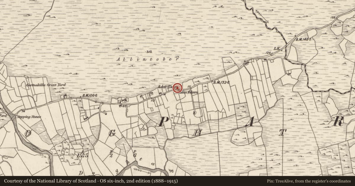
- First-edition OS map
- Toberfeheen
- Latest-edition OS map
- Tober Feheen
- Coordinates
- 53.51980, -9.47521
- SMR number
- GA026-009001-
Slide toward Today to fade the historical sheet and see the modern map underneath.
David Rumsey Map Collection, Stanford LibrariesDavid Rumsey Map Collection, Stanford LibrariesDavid Rumsey Map Collection, Stanford LibrariesDavid Rumsey Map Collection, Stanford Libraries
4 historical maps cover this location, the earliest the 1753 map "Mappa geographica Regni Hiberniae" (David Rumsey Map Collection, Stanford Libraries).
Historical maps covering this location
- 1753 · Mappa geographica Regni Hiberniae (David Rumsey Map Collection, Stanford Libraries)
- 1790 · Composite: Ireland. (David Rumsey Map Collection, Stanford Libraries)
- 1869 · Ireland. (David Rumsey Map Collection, Stanford Libraries)
- 1891 · Ireland 16 (David Rumsey Map Collection, Stanford Libraries)
This record in the National Monuments Service's Historic Environment Viewer ↗
The National Monuments Service's description
On the roadside on N side of the Dooghta River valley. A pair of holy wells, fed from a small stream, which are dedicated to Muire (GA026-009----) and Fechín (GA026009001-). They are delimited by a rectangular drystone structure, E-shaped on plan (L 3.45m, Wth 2.9m, H 1.25m), the wells being located within its arms. A number of modern offerings are in evidence. According to local tradition, the wells originally contained a stone idol which had power over the weather; it was eventually smashed to pieces by St Fechín of Cong. The OS Letters recorded the existence of 'a flag stone called Leac Fechín [near St Fechín's Well; GA026-009002-] by which men were put to the ordeal!' (O'Flanagan 1927a, Vol. 3, 42), but no visible trace of it was found. (Hardiman 1846, 120-1)
The above description is derived from the published 'Archaeological Inventory of County Galway Vol. I - West Galway'. Compiled by Paul Gosling (Dublin: Stationery Office, 1993).
Date of upload: 05 August 2010
Nearby in the register
- Ritual site - holy wellunder 1 mi
- Graveyardunder 1 mi
- Water mill - unclassifiedunder 1 mi
- Crannogunder 1 mi
Other entries of the same register within about three miles of this one, by straight line.