Sites and Monuments Record · Ireland
Megalithic tomb - court tomb
Cleggan, County Galway, Ireland
The record
- Townland
- Cleggan
- County
- Galway
- Country
- Ireland
- First-edition OS map
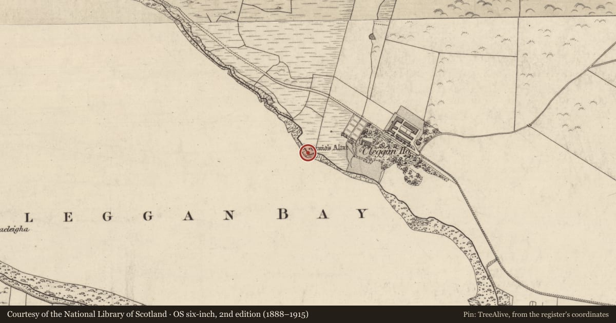
- Druids Altar
- Latest-edition OS map
- Druids Altar
- Coordinates
- 53.56171, -10.10422
- SMR number
- GA022-014----
Slide toward Today to fade the historical sheet and see the modern map underneath.
David Rumsey Map Collection, Stanford LibrariesDavid Rumsey Map Collection, Stanford LibrariesDavid Rumsey Map Collection, Stanford LibrariesDavid Rumsey Map Collection, Stanford Libraries
4 historical maps cover this location, the earliest the 1790 map "Composite: Ireland." (David Rumsey Map Collection, Stanford Libraries).
Historical maps covering this location
- 1790 · Composite: Ireland. (David Rumsey Map Collection, Stanford Libraries)
- 1841 · Ireland. (David Rumsey Map Collection, Stanford Libraries)
- 1869 · Ireland. (David Rumsey Map Collection, Stanford Libraries)
- 1891 · Ireland 16 (David Rumsey Map Collection, Stanford Libraries)
This record in the National Monuments Service's Historic Environment Viewer ↗
The National Monuments Service's description
On N shore of Cleggan Bay. The remains of this tomb consist of a gallery aligned ESE-WNW. The front, E portion appears incomplete. The orthostats running E of the pair of transversely set jambs could be interpreted as chamber sidestones or as defining a narrow asymmetrical court. The gallery to W of these is divided into two chambers by a septal stone and jamb. The innermost W chamber is distinctly narrower and of lighter construction than the rest of the monument. A large roofstone covers the adjoining E chamber and a long stone, probably a displaced lintel, lies in this chamber immediately W of the jambs. The remains of the mound survive on S side of the monument. (de Valera and Ó Nualláin 1972, 5-7)
The above description is derived from the published 'Archaeological Inventory of County Galway Vol. I - West Galway'. Compiled by Paul Gosling (Dublin: Stationery Office, 1993).
Date of upload: 05 August 2010
See linked document with details from Ruaidhrí de Valera and Seán Ó Nualláin, Survey of the Megalithic Tombs of Ireland. Volume III. Counties Galway, Roscommon, Leitrim, Longford, Westmeath, Laoighis, Offaly, Kildare, Cavan. (Dublin: Stationery Office, 1972).
Nearby in the register
- Signal towerunder 1 mi
- Cairn - unclassifiedunder 1 mi
- Ringfort - cashelunder 1 mi
- Sundialunder 1 mi
Other entries of the same register within about three miles of this one, by straight line.