Sites and Monuments Record · Ireland
Church
Cartron (Ballynahinch By.), County Galway, Ireland
The record
- Townland
- Cartron (Ballynahinch By.)
- County
- Galway
- Country
- Ireland
- First-edition OS map
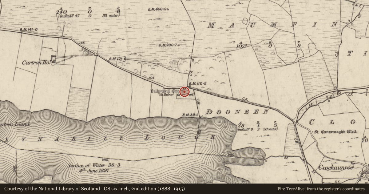
- Ballynakill Church
- Latest-edition OS map
- Ballynakill Church (in Ruins)
- Coordinates
- 53.55722, -10.04125
- SMR number
- GA022-012----
Slide toward Today to fade the historical sheet and see the modern map underneath.
David Rumsey Map Collection, Stanford LibrariesDavid Rumsey Map Collection, Stanford LibrariesDavid Rumsey Map Collection, Stanford LibrariesDavid Rumsey Map Collection, Stanford Libraries
4 historical maps cover this location, the earliest the 1753 map "Mappa geographica Regni Hiberniae" (David Rumsey Map Collection, Stanford Libraries).
Historical maps covering this location
- 1753 · Mappa geographica Regni Hiberniae (David Rumsey Map Collection, Stanford Libraries)
- 1790 · Composite: Ireland. (David Rumsey Map Collection, Stanford Libraries)
- 1869 · Ireland. (David Rumsey Map Collection, Stanford Libraries)
- 1891 · Ireland 16 (David Rumsey Map Collection, Stanford Libraries)
This record in the National Monuments Service's Historic Environment Viewer ↗
The National Monuments Service's description
In a subrectangular graveyard (GA022-012001-) overlooking Ballynakill Lough to the S. This poorly preserved medieval church (E-W; L 20.2m, Wth 6.1m) is dedicated to St Ceannanach (Hardiman 1846, 118). Only the W gable wall survives to its full height; the N and S walls, and E gable are in a much-collapsed state. There is a robbed-out doorway in the S wall, a twin-light round-headed window with a small circular ope above in the W gable and a wall cupboard in the N end of the E gable. The interior is divided by a later wall. When visited in October 1983 the interior of the church was heavily overgrown. During a revisit May 2017 it was noted that much of the overgrowth had been removed. A fragment of a hanging eye associated with the doorway was visible in the internal wall-face of the S wall. A number of dressed arched stones lying on the ground to the S of the church are part of the original doorway. Two cross-slabs (GA022-012003- and GA022-012004-) are visible in the graveyard. (Killanin 1954, 97; O'Flanagan 1927a, Vol. 3, 30-1; Tully Cross I.C.A. 1985, 6-7)
The above description is derived from the published 'Archaeological Inventory of County Galway Vol. I - West Galway'. Compiled by Paul Gosling (Dublin: Stationery Office, 1993). In certain instances the entries have been revised and updated in the light of recent research.
The following images have been uploaded:
GA022-012----_01 Church from S.jpg
GA022-012----_02 Window in W gable wall from W.jpg
GA022-012----_03 Window in W gable wall from E.jpg
GA022-012----_04 Possible hanging eye in S wall.jpg
GA022-012----_05 General view from E.jpg
Updated by: Olive Alcock
Date of revised upload: 28 March 2017
Nearby in the register
- Graveyardunder 1 mi
- Cross-slabunder 1 mi
- Cross-inscribed pillarunder 1 mi
- Crossunder 1 mi
Other entries of the same register within about three miles of this one, by straight line.