Sites and Monuments Record · Ireland
Megalithic tomb - court tomb
Ballynew (Ballynahinch By.), County Galway, Ireland
The record
- Townland
- Ballynew (Ballynahinch By.)
- County
- Galway
- Country
- Ireland
- First-edition OS map
- Not indicated
- Latest-edition OS map
- Not indicated
- Coordinates
- 53.56168, -10.06779
- SMR number
- GA022-006----
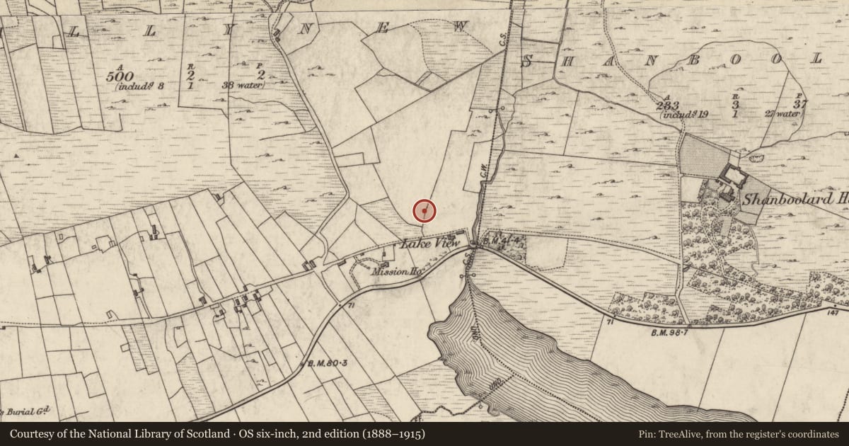
Slide toward Today to fade the historical sheet and see the modern map underneath.
David Rumsey Map Collection, Stanford LibrariesDavid Rumsey Map Collection, Stanford LibrariesDavid Rumsey Map Collection, Stanford LibrariesDavid Rumsey Map Collection, Stanford Libraries
4 historical maps cover this location, the earliest the 1790 map "Composite: Ireland." (David Rumsey Map Collection, Stanford Libraries).
Historical maps covering this location
- 1790 · Composite: Ireland. (David Rumsey Map Collection, Stanford Libraries)
- 1841 · Ireland. (David Rumsey Map Collection, Stanford Libraries)
- 1869 · Ireland. (David Rumsey Map Collection, Stanford Libraries)
- 1891 · Ireland 16 (David Rumsey Map Collection, Stanford Libraries)
This record in the National Monuments Service's Historic Environment Viewer ↗
The National Monuments Service's description
On W side of a small valley overlooking Bundouglas Cove to N and Ballynakill Lough to SE. The monument is ruined and the remains comprise four stones. At E are two well-matched jambs which probably mark the entrance to a gallery. The other two stones form part of S side of the gallery. The remains are sufficient to indicate that the monument was a court-tomb (de Valera and Ó Nualláin 1972, 7). This is one of a group of five tombs (GA022-007----, GA022-008----, GA022-063001-, GA022-106----) which, with a stone row (GA022-060----), a stone pair (GA022-009----); pre-bog field walls (GA022-077----) and several houses (GA022-113-----GA022-113007-), are centred on Lough Sheeauns c. 1km to SW. (Gibbons and Higgins 1988b; Molloy and O'Connell 1987)
The above description is derived from the published 'Archaeological Inventory of County Galway Vol. I - West Galway'. Compiled by Paul Gosling (Dublin: Stationery Office, 1993).
Date of upload: 05 August 2010
See linked document with details from Ruaidhrí de Valera and Seán Ó Nualláin, Survey of the Megalithic Tombs of Ireland. Volume III. Counties Galway, Roscommon, Leitrim, Longford, Westmeath, Laoighis, Offaly, Kildare, Cavan. (Dublin: Stationery Office, 1972).
Nearby in the register
- Ringfort - rathunder 1 mi
- Penitential stationunder 1 mi
- Crossunder 1 mi
- Standing stone - pairunder 1 mi
Other entries of the same register within about three miles of this one, by straight line.