Sites and Monuments Record · Ireland
Church
Cashleen, County Galway, Ireland
The record
- Townland
- Cashleen
- County
- Galway
- Country
- Ireland
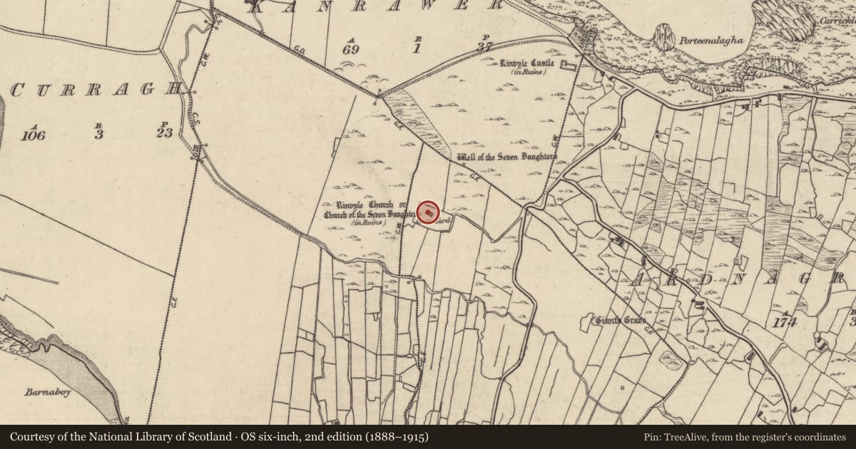
- First-edition OS map
- Rinvyle Church . . . (in ruins)
- Latest-edition OS map
- Rinvyle Church . . . (in Ruins)
- Coordinates
- 53.60440, -10.03403
- SMR number
- GA009-004----
Slide toward Today to fade the historical sheet and see the modern map underneath.
David Rumsey Map Collection, Stanford LibrariesDavid Rumsey Map Collection, Stanford LibrariesDavid Rumsey Map Collection, Stanford LibrariesDavid Rumsey Map Collection, Stanford Libraries
4 historical maps cover this location, the earliest the 1753 map "Mappa geographica Regni Hiberniae" (David Rumsey Map Collection, Stanford Libraries).
Historical maps covering this location
- 1753 · Mappa geographica Regni Hiberniae (David Rumsey Map Collection, Stanford Libraries)
- 1790 · Composite: Ireland. (David Rumsey Map Collection, Stanford Libraries)
- 1869 · Ireland. (David Rumsey Map Collection, Stanford Libraries)
- 1891 · Ireland 16 (David Rumsey Map Collection, Stanford Libraries)
This record in the National Monuments Service's Historic Environment Viewer ↗
The National Monuments Service's description
In the older part of a graveyard, 400m SW of Renvyle Castle (GA009-015----). A medieval church (E-W; L 13.1m, Wth 5m ext.), also named 'Church of the Seven Daughters' on OS 6-inch map. Three walls survive almost intact, but most of W has collapsed. The doorway, with pointed arch, is in N wall. There is a fine single-light window with triangular head in E wall with an altar below it and two aumbries in SE corner. A partially robbed window is visible in S wall, and a later dividing wall towards W end. Beam-slots in S wall indicate a former loft or gallery at W end. Possible traces of an earlier doorway are visible in masonry of collapsed wall. A holy well (GA009-016----) lies c. 120m to NNE. (O'Flanagan 1927a, Vol. 3, 26-7; Killanin 1954, 99; Topgr. Files, NMI)
The above description is derived from the published 'Archaeological Inventory of County Galway Vol. I - West Galway'. Compiled by Paul Gosling (Dublin: Stationery Office, 1993).
Date of upload: 05 August 2010
Nearby in the register
- Graveyardunder 1 mi
- Ritual site - holy wellunder 1 mi
- Cursing stoneunder 1 mi
- Fulacht fiaunder 1 mi
Other entries of the same register within about three miles of this one, by straight line.