Sites and Monuments Record · Ireland
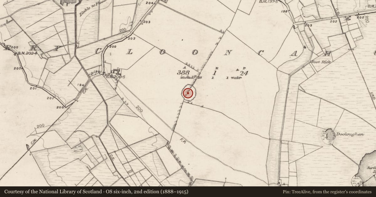
Hilltop enclosure
Clooncah (Ballymoe By.), County Galway, Ireland
The record
- Townland
- Clooncah (Ballymoe By.)
- County
- Galway
- Country
- Ireland
- First-edition OS map
- Hachured
- Latest-edition OS map
- Hachured
- Coordinates
- 53.64540, -8.39137
- SMR number
- GA007-041----
Slide toward Today to fade the historical sheet and see the modern map underneath.
David Rumsey Map Collection, Stanford LibrariesDavid Rumsey Map Collection, Stanford LibrariesDavid Rumsey Map Collection, Stanford LibrariesDavid Rumsey Map Collection, Stanford Libraries
4 historical maps cover this location, the earliest the 1790 map "Composite: Ireland." (David Rumsey Map Collection, Stanford Libraries).
Historical maps covering this location
- 1790 · Composite: Ireland. (David Rumsey Map Collection, Stanford Libraries)
- 1811 · Ireland. (David Rumsey Map Collection, Stanford Libraries)
- 1869 · Ireland. (David Rumsey Map Collection, Stanford Libraries)
- 1891 · Ireland 16 (David Rumsey Map Collection, Stanford Libraries)
This record in the National Monuments Service's Historic Environment Viewer ↗
The National Monuments Service's description
On a hill summit in pastureland. A large poorly preserved subcircular enclosure (NW-SE 85m, NE-SW 65m) defined by a fosse, divided in two by a modern field bank running NNE-SSW. A site inspection in 1967 (Topgr. Files, OPW) recorded that it was 'bounded by a collapsed stone wall (overgrown and giving superficial appearance of a bank). Big wide deep fosse inside'. Subsequently levelled, it is now defined by a broad shallow fosse (Wth 5m). Outside the fosse, a band of nettles and thistles is visible from WNW to N, possibly indicating the line of the outer bank/wall. Traces of a possible causeway across the fosse are visible at N. The interior is flat but is slightly lower than the exterior. A battlefield (GA007-042----) lies immediately to E.
The above description is derived from the published 'Archaeological Inventory of County Galway Vol. II - North Galway'. Compiled by Olive Alcock, Kathy de hÓra and Paul Gosling (Dublin: Stationery Office, 1999).
Date of upload: 05 August 2010
Nearby in the register
- Earthworkunder 1 mi
- Burialunder 1 mi
- Enclosureunder 1 mi
- Designed landscape featureunder 1 mi
Other entries of the same register within about three miles of this one, by straight line.