Sites and Monuments Record · Ireland
Bullaun stone
Rathmichael, County Dublin, Ireland
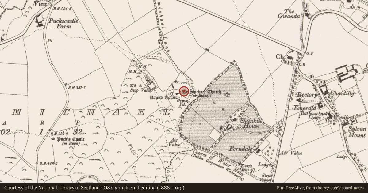
The record
- Townland
- Rathmichael
- County
- Dublin
- Country
- Ireland
- Coordinates
- 53.23296, -6.14587
- SMR number
- DU026-050010-
Slide toward Today to fade the historical sheet and see the modern map underneath.
David Rumsey Map Collection, Stanford LibrariesDavid Rumsey Map Collection, Stanford LibrariesDavid Rumsey Map Collection, Stanford LibrariesDavid Rumsey Map Collection, Stanford Libraries
4 historical maps cover this location, the earliest the 1799 map "Ireland." (David Rumsey Map Collection, Stanford Libraries).
Historical maps covering this location
- 1799 · Ireland. (David Rumsey Map Collection, Stanford Libraries)
- 1811 · Ireland. (David Rumsey Map Collection, Stanford Libraries)
- 1841 · Ireland. (David Rumsey Map Collection, Stanford Libraries)
- 1891 · Ireland 16 (David Rumsey Map Collection, Stanford Libraries)
This record in the National Monuments Service's Historic Environment Viewer ↗
The National Monuments Service's description
There is an earth fast boulder c. 60m NE of Rathmichael church (DU026-050001-) containing a bullaun at ground level. The OS Letters describe a baptismal font, which stood on a pedestal near the church. This is probably the same font later described as broken and sunk near the gate (Westropp 1894, 180-181).
Compiled by: Geraldine Stout and Padraig Clancy.
Revised upload on: 15 April 2018.
References
Westropp, T.J. 1894 Rathmichael, Co. Dublin. Journal of the Royal Society of Antiquaries of Ireland 24, 180-81.
Nearby in the register
- Holed stoneunder 1 mi
- Graveslabunder 1 mi
- Churchunder 1 mi
- Crossunder 1 mi
Other entries of the same register within about three miles of this one, by straight line.