Sites and Monuments Record · Ireland
Graveyard
Glassavullaun, County Dublin, Ireland
The record
- Townland
- Glassavullaun
- County
- Dublin
- Country
- Ireland
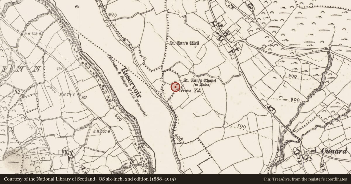
- First-edition OS map
- Grave Yard
- Latest-edition OS map
- Grave Yard
- Coordinates
- 53.23203, -6.35142
- SMR number
- DU025-033002-
Slide toward Today to fade the historical sheet and see the modern map underneath.
David Rumsey Map Collection, Stanford LibrariesDavid Rumsey Map Collection, Stanford LibrariesDavid Rumsey Map Collection, Stanford LibrariesDavid Rumsey Map Collection, Stanford Libraries
4 historical maps cover this location, the earliest the 1790 map "Composite: Ireland." (David Rumsey Map Collection, Stanford Libraries).
Historical maps covering this location
- 1790 · Composite: Ireland. (David Rumsey Map Collection, Stanford Libraries)
- 1799 · Ireland. (David Rumsey Map Collection, Stanford Libraries)
- 1811 · Ireland. (David Rumsey Map Collection, Stanford Libraries)
- 1891 · Ireland 16 (David Rumsey Map Collection, Stanford Libraries)
This record in the National Monuments Service's Historic Environment Viewer ↗
The National Monuments Service's description
Kilmasantan church and graveyard situated on W facing slope of rising ground overlooking the E bank of the River Dodder in Glenasmole, in the Dublin Mountains. A graveyard sub-rectangular in plan (dims. 57m SW-NE x 37m NW-SE) enclosed by a post-1700 stone wall with entrance gate at E. Within the graveyard is a church (DU025-033001-) and inside the gate to the N there is a medieval font (DU025-033003-). In 1179 this church and its lands were a sub-manor of Tallaght and part of the extensive church lands of the See of Dublin. This manor occupied the upper eastern Dodder Valley (Nolan 1992, 185). Possible ecclesiastical enclosure (DU025-033005-) of Kilmansantan monastery adjoining the N side of this graveyard.
Compiled by: Geraldine Stout and Padraig Clancy
Revised by: Caimin O'Brien
Date of revised upload: 10 March 2023
References
Nolan, W. 1992 Society and settlement in the valley of Glenasmole c. 1750-c.1900. In F.H.A. Aalen and K. Whelan (eds), Dublin city and county: from prehistory to present. Dublin. Geography Publications.
Nearby in the register
- Fontunder 1 mi
- Ecclesiastical siteunder 1 mi
- Churchunder 1 mi
- Ecclesiastical enclosureunder 1 mi
Other entries of the same register within about three miles of this one, by straight line.