Sites and Monuments Record · Ireland
Barrow - ring-barrow
Lugg, County Dublin, Ireland
The record
- Townland
- Lugg
- County
- Dublin
- Country
- Ireland
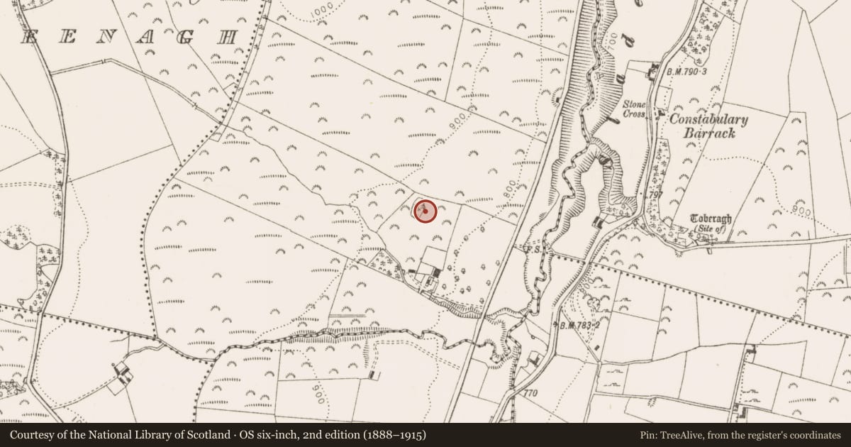
- Latest-edition OS map
- Indicated
- Coordinates
- 53.25534, -6.45512
- SMR number
- DU024-009004-
Slide toward Today to fade the historical sheet and see the modern map underneath.
David Rumsey Map Collection, Stanford LibrariesDavid Rumsey Map Collection, Stanford LibrariesDavid Rumsey Map Collection, Stanford LibrariesDavid Rumsey Map Collection, Stanford Libraries
4 historical maps cover this location, the earliest the 1799 map "Ireland." (David Rumsey Map Collection, Stanford Libraries).
Historical maps covering this location
- 1799 · Ireland. (David Rumsey Map Collection, Stanford Libraries)
- 1811 · Ireland. (David Rumsey Map Collection, Stanford Libraries)
- 1830 · V.3:11-15:XV. Britisches Reich. C. Kon: Ireland. a. Prov: Leinster. Counties: 1-12 (David Rumsey Map Collection, Stanford Libraries)
- 1891 · Ireland 16 (David Rumsey Map Collection, Stanford Libraries)
This record in the National Monuments Service's Historic Environment Viewer ↗
The National Monuments Service's description
Situated on the crest of a ridge at the rear of Glenaraneen House. The ground falls away steeply to the Slade valley and there is a stream to the S of the site. A ring barrow, the N barrow (ext. diam. 11) of three, is defined by an outer bank (Wth 2.5m; H 0.3m) and internal fosse (Wth 0.95m; D 0.25m)(DU024-009004-).
The central barrow (ext. diam. 12m) of three, is defined by an outer bank (Wth 2.5m; H 0.3m) and inner fosse (Wth 1.1m; D 0.28m)(DU024-009003-). The southernmost (ext. diam. 14m) of three, is defined by an outer bank (Wth 2.3-2.5m; H 1.2m) and inner fosse (Wth 2.5m; D0.45m)(DU024-009002-). The southern section of this site is formed by the bank of the outer enclosing area. The banks of the three possible ring-barrows are planted with scots pine, the outer barrow is planted with thorn. An oval or subrectangular area extending N-S (L 36m; Wth 24m) defined by a bank (Wth 2.3-2.5m; H 1.2m) and outer fosse (Wth 2.5m; D 0.45m)(DU024-009001-) encloses the three possible ring- barrows.
Compiled by: Geraldine Stout and Padraig Clancy
Revised upload on: 6 July 2018.
Nearby in the register
- Barrow - ring-barrowunder 1 mi
- Barrow - ring-barrowunder 1 mi
- Enclosureunder 1 mi
- Ritual site - holy wellunder 1 mi
Other entries of the same register within about three miles of this one, by straight line.