Sites and Monuments Record · Ireland
Fulacht fia
Carmanhall And Leopardstown,Murphystown, County Dublin, Ireland
The record
- Townland
- Carmanhall And Leopardstown,Murphystown
- County
- Dublin
- Country
- Ireland
- Latest-edition OS map
- Not indicated
- Coordinates
- 53.26559, -6.20018
- SMR number
- DU023-061----
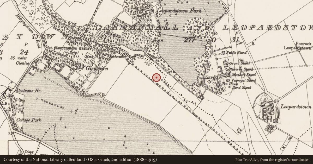
Slide toward Today to fade the historical sheet and see the modern map underneath.
David Rumsey Map Collection, Stanford LibrariesDavid Rumsey Map Collection, Stanford LibrariesDavid Rumsey Map Collection, Stanford LibrariesDavid Rumsey Map Collection, Stanford Libraries
4 historical maps cover this location, the earliest the 1799 map "Ireland." (David Rumsey Map Collection, Stanford Libraries).
Historical maps covering this location
- 1799 · Ireland. (David Rumsey Map Collection, Stanford Libraries)
- 1811 · Ireland. (David Rumsey Map Collection, Stanford Libraries)
- 1841 · Ireland. (David Rumsey Map Collection, Stanford Libraries)
- 1891 · Ireland 16 (David Rumsey Map Collection, Stanford Libraries)
This record in the National Monuments Service's Historic Environment Viewer ↗
The National Monuments Service's description
A fulacht fia identified during pre-development topsoil stripping under licence 02E0330. A spread of black charcoal-rich soil measuring 12m by 10m beside an ornamental pond of 18th or 19th century date. When this was cleaned back, it proved to be the higher, central part of a more extensive spread; the lower part had been covered with clay containing pottery and glass of recent date. A wall footing was later dug into this, forming three sides of a rectangle, measuring 7m by 4.5m. The spread of the fulacht fia consisted of a number of distinct layers and lenses and overlay four shallow depressions, which may have been artificial, and one approximately rectangular pit, measuring 2.56m by 1.2m by 0.8m deep. (Breen 2004, 177).
Compiled by: Geraldine Stout and Padraig Clancy
Revised upload on: 6 July 2018
References
Breen, T. 2004a Murphystown, Carmanhall and Leopardstown. In I. Bennett (ed.), Excavations 2002: summary accounts of archaeological excavations in Ireland, 177. Bray. Wordwell.
Nearby in the register
- Burial groundunder 1 mi
- Flat cemeteryunder 1 mi
- Castle - tower houseunder 1 mi
- Field boundaryunder 1 mi
Other entries of the same register within about three miles of this one, by straight line.