Sites and Monuments Record · Ireland
Castle - Anglo-Norman masonry castle
Dundrum, County Dublin, Ireland
The record
- Townland
- Dundrum
- County
- Dublin
- Country
- Ireland
- First-edition OS map
- Castle
- Latest-edition OS map
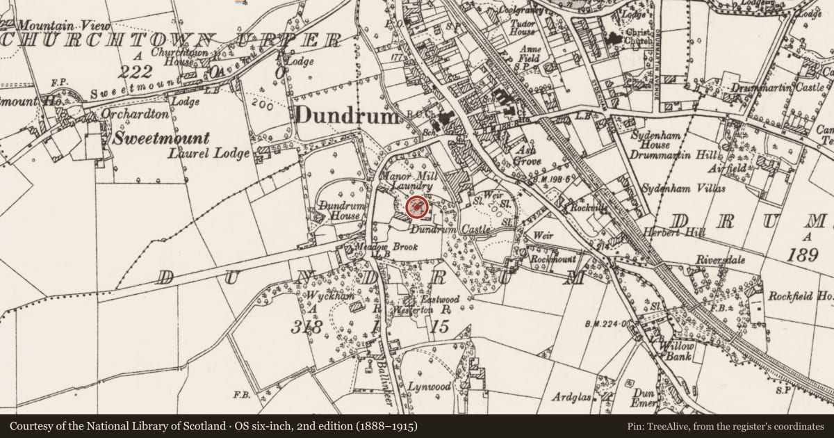
- Dundrum Castle
- Coordinates
- 53.28777, -6.24508
- SMR number
- DU022-023002-
Slide toward Today to fade the historical sheet and see the modern map underneath.
David Rumsey Map Collection, Stanford LibrariesDavid Rumsey Map Collection, Stanford LibrariesDavid Rumsey Map Collection, Stanford LibrariesDavid Rumsey Map Collection, Stanford Libraries
4 historical maps cover this location, the earliest the 1799 map "Ireland." (David Rumsey Map Collection, Stanford Libraries).
Historical maps covering this location
- 1799 · Ireland. (David Rumsey Map Collection, Stanford Libraries)
- 1811 · Ireland. (David Rumsey Map Collection, Stanford Libraries)
- 1841 · Ireland. (David Rumsey Map Collection, Stanford Libraries)
- 1891 · Ireland 16 (David Rumsey Map Collection, Stanford Libraries)
This record in the National Monuments Service's Historic Environment Viewer ↗
The National Monuments Service's description
Situated on top of an E facing ridge overlooking the river Slang. Dundrum Castle is a late 16th-17th century tower house (DU022-023001-) which incorporates part of a 12th-14th-century castle exposed during excavations in 1988-91 (O'Brien 1987, 14; O' Brien 1989, 136-137). Built by Sir John de Clahull c. 1187, the earliest feature exposed is a section of fosse (Wth 7m, D 1.40m) that enclosed the top of the ridge. Finds included Leinster cooking ware, a buckle and a socketed arrowhead. Associated with this moat was a triple-slotted drawbridge with an entrance to a gatehouse extending from the drawbridge to part of the outer wall of the early castle (Wth 2m). Part of a stone-lined watercourse runs under the base of the wall and the shaft of a garderobe was revealed within the wall. (Newman Johnson 2014)
Compiled by: Geraldine Stout
Updated by: Paul Walsh
Revised date of upload: 16 April 2015
References
Newman Johnson, D. 2014 The fort on the ridge in the marches of the Pale: Dundrum Castle, Co. Dublin. In P. Ettel, A.-M. Flambard Héricher and K. O Conor (eds), Chateau Gaillard 26. Etudes de castellogogie medieval. Chateau et frontiere, 295-303.
O'Brien, C. 1988 Dundrum castle, Dundrum. In I. Bennett (ed.), Excavations 1987: summary accounts of archaeological excavations in Ireland, 13-14. Bray. Wordwell.
O'Brien, E. 1989 Excavation at Dundrum Castle, Dundrum, Co. Dublin. Archaeology Ireland 3, 136-7.
Nearby in the register
- Castle - tower houseunder 1 mi
- Ecclesiastical enclosureunder 1 mi
- Graveyardunder 1 mi
- Churchunder 1 mi
Other entries of the same register within about three miles of this one, by straight line.