Sites and Monuments Record · Ireland
Ringfort - unclassified
Baldonnell Little, County Dublin, Ireland
The record
- Townland
- Baldonnell Little
- County
- Dublin
- Country
- Ireland
- First-edition OS map
- Raheen
- Latest-edition OS map
- Not indicated
- Coordinates
- 53.30118, -6.43337
- SMR number
- DU021-020----
Slide toward Today to fade the historical sheet and see the modern map underneath.
David Rumsey Map Collection, Stanford LibrariesDavid Rumsey Map Collection, Stanford LibrariesDavid Rumsey Map Collection, Stanford LibrariesDavid Rumsey Map Collection, Stanford Libraries
4 historical maps cover this location, the earliest the 1790 map "Composite: Ireland." (David Rumsey Map Collection, Stanford Libraries).
Historical maps covering this location
- 1790 · Composite: Ireland. (David Rumsey Map Collection, Stanford Libraries)
- 1799 · Ireland. (David Rumsey Map Collection, Stanford Libraries)
- 1811 · Ireland. (David Rumsey Map Collection, Stanford Libraries)
- 1891 · Ireland 16 (David Rumsey Map Collection, Stanford Libraries)
This record in the National Monuments Service's Historic Environment Viewer ↗
The National Monuments Service's description
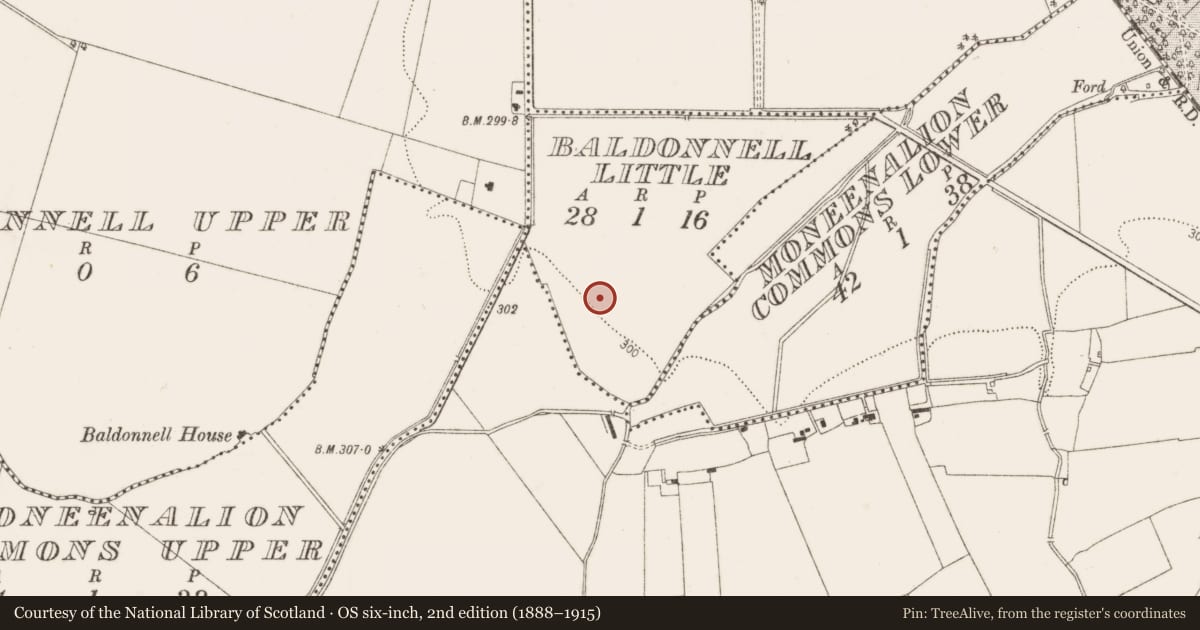
Located in flat low-lying land it is indicated as a circular enclosure and named 'Raheen' on the 1st ed. OS 6-inch map: the monument was not indicated on any subsequent edition. On inspection in 1986 it was seen to consist of a raised circular area (int. diam.33m) defined by a bank (H 0.3m) in the SE-W with traces of an external fosse (Wth 7-13m). A possible entrance was indentified in the NE sector. A review of LiDAR in 2011 demonstrated the remains were those of a tri-vallate enclosure and geophysical survey (licence no. 13R0087) was undertaken in 2013 with limited results (pers. comm. S. Davis). (Ua Broin 1944, 206; Healy 1974, 24)
Compiled by: Geraldine Stout, Paul Walsh
Date of upload: 4 February 2014
References
Ua Broin, L. 1944 Clondalkin, Co. Dublin and it's neighbourhood. Journal of the Royal Society of Antiquaries of Ireland 74, 191-218.
Healy, P. 1975b Third report on monuments and sites of archaeological interest in county Dublin. An Foras Forbartha, Dublin.
Healy, P. 1975a Second report on monuments and sites of archaeological interest in county Dublin. An Foras Forbartha Teoranta.
Nearby in the register
- Kiln - corn-dryingunder 1 mi
- Ecclesiastical enclosureunder 1 mi
- Graveyardunder 1 mi
- Churchunder 1 mi
Other entries of the same register within about three miles of this one, by straight line.