Sites and Monuments Record · Ireland
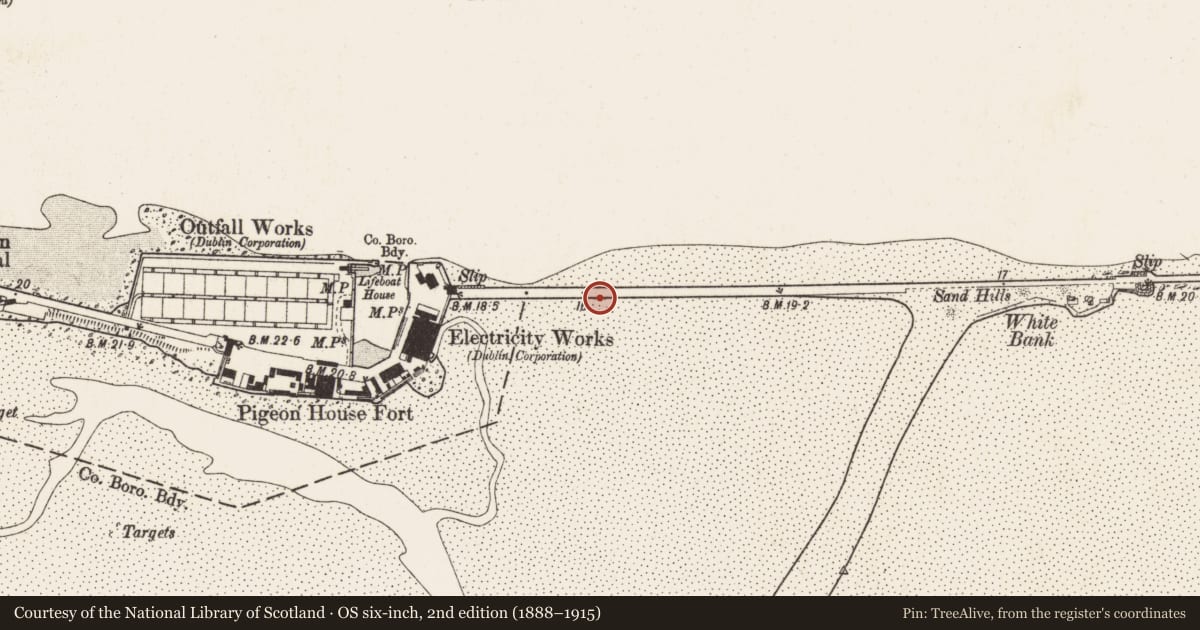
Sea wall
County Dublin, Ireland
The record
- County
- Dublin
- Country
- Ireland
- Coordinates
- 53.34071, -6.18843
- SMR number
- DU019-029002-
Slide toward Today to fade the historical sheet and see the modern map underneath.
David Rumsey Map Collection, Stanford LibrariesDavid Rumsey Map Collection, Stanford LibrariesDavid Rumsey Map Collection, Stanford LibrariesDavid Rumsey Map Collection, Stanford Libraries
4 historical maps cover this location, the earliest the 1799 map "Ireland." (David Rumsey Map Collection, Stanford Libraries).
Historical maps covering this location
- 1799 · Ireland. (David Rumsey Map Collection, Stanford Libraries)
- 1811 · Ireland. (David Rumsey Map Collection, Stanford Libraries)
- 1841 · Ireland. (David Rumsey Map Collection, Stanford Libraries)
- 1891 · Ireland 16 (David Rumsey Map Collection, Stanford Libraries)
This record in the National Monuments Service's Historic Environment Viewer ↗
The National Monuments Service's description
In 1759 the Ballast Office wall, a double stone wall was constructed at Ringsend. The two walls varied from 11m to 14m apart and the space between was filled with sand (De Courcy 1996, 377).
References
De Courcy, J. 1996 The Liffey in Dublin. Dublin. Gill and Macmillan.
Nearby in the register
- Batteryunder 1 mi
- Signal towerunder 1 mi
- Barracksunder 1 mi
- Battery1 mi
Other entries of the same register within about three miles of this one, by straight line.