Sites and Monuments Record · Ireland
Church
Palmerstown Lower, County Dublin, Ireland
The record
- Townland
- Palmerstown Lower
- County
- Dublin
- Country
- Ireland
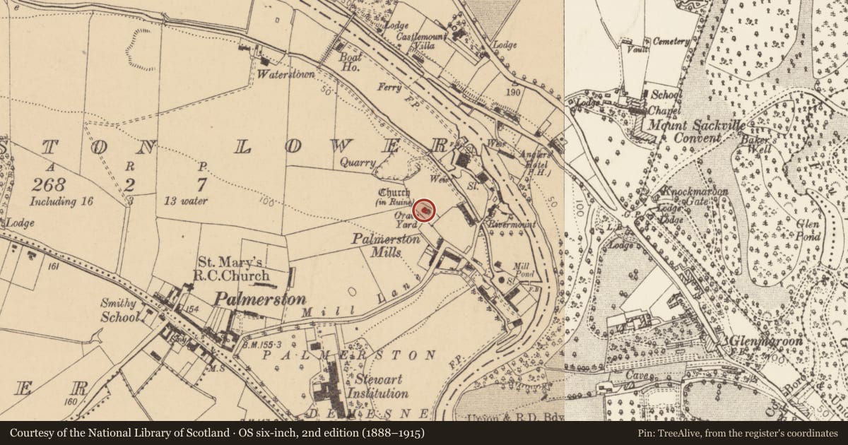
- Latest-edition OS map
- Church (in ruins)
- Coordinates
- 53.35798, -6.36284
- SMR number
- DU017-026001-
Slide toward Today to fade the historical sheet and see the modern map underneath.
David Rumsey Map Collection, Stanford LibrariesDavid Rumsey Map Collection, Stanford LibrariesDavid Rumsey Map Collection, Stanford LibrariesDavid Rumsey Map Collection, Stanford Libraries
4 historical maps cover this location, the earliest the 1790 map "Composite: Ireland." (David Rumsey Map Collection, Stanford Libraries).
Historical maps covering this location
- 1790 · Composite: Ireland. (David Rumsey Map Collection, Stanford Libraries)
- 1799 · Ireland. (David Rumsey Map Collection, Stanford Libraries)
- 1811 · Ireland. (David Rumsey Map Collection, Stanford Libraries)
- 1891 · Ireland 16 (David Rumsey Map Collection, Stanford Libraries)
This record in the National Monuments Service's Historic Environment Viewer ↗
The National Monuments Service's description
Located off Mill Lane on a natural shelf overlooking the River Liffey. The present church is multi-period in date. In the Twelfth century the church at Palmerstown was held by the Fratres Cruciferi (Ball 1906, 100). It comprises a nave and chancel, aligned NW-SE. The walls survive to the eaves with steeply pitched gables. Built of large blocks of randomly coursed masonry. There is a belfry over the W gable. The nave is entered from the W gable. The doorway has inclined jambs indicating a pre-Norman origin, with a later round-headed window inserted. Also inserted into the S wall is a later featureless window. The nave (dims. L 9m, Wth, 5m) is lit in the N by a double-light window with chamfered jambs and signs of drafting present. The chancel (int. dims. L 4.32m, Wth 3.1m, T 0.84m) is entered through a chancel arch which rises from roughly squared imposts and contains moulding. The E window is a double light, the mullion missing, and had, originally a pointed arch (Wakeman 1892, 101-106, Healy 1974, 22; Ní Mharcaigh 1997, 27-5).
Compiled by: Geraldine Stout
Date of upload: 26 August 2011
References
Wakeman, W.F. 1892 Ante - Norman churches in the county of Dublin. Journal of the Royal Society of Antiquaries of Ireland 22, 101-6.
Ní Mharcaigh, M. 1997 The medieval parish churches of south-west County Dublin. Proceedings of the Royal Irish Academy 97C, 245-96.
Ball, E.F. 1902-20 (Reprint 1979) A history of the County Dublin, 6 vols. Dublin. Gill and Macmillan.
Nearby in the register
- Graveyardunder 1 mi
- Quarryunder 1 mi
- Barrow - ring-barrowunder 1 mi
- Icehouseunder 1 mi
Other entries of the same register within about three miles of this one, by straight line.