Sites and Monuments Record · Ireland
Castle - motte and bailey
Castleknock (Without Phoenix Park), County Dublin, Ireland
The record
- Townland
- Castleknock (Without Phoenix Park)
- County
- Dublin
- Country
- Ireland
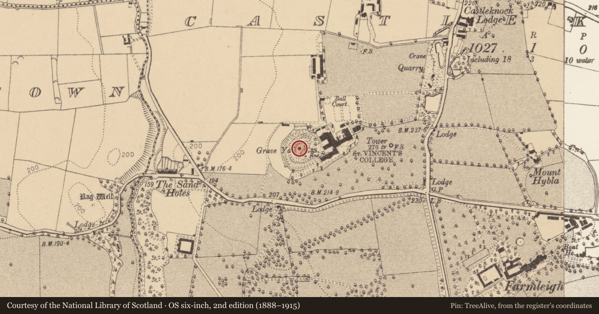
- First-edition OS map
- Hachured Castle in ruins and Fort
- Latest-edition OS map
- Hachured
- Coordinates
- 53.36817, -6.36997
- SMR number
- DU017-012001-
Slide toward Today to fade the historical sheet and see the modern map underneath.
David Rumsey Map Collection, Stanford LibrariesDavid Rumsey Map Collection, Stanford LibrariesDavid Rumsey Map Collection, Stanford LibrariesDavid Rumsey Map Collection, Stanford Libraries
4 historical maps cover this location, the earliest the 1790 map "Composite: Ireland." (David Rumsey Map Collection, Stanford Libraries).
Historical maps covering this location
- 1790 · Composite: Ireland. (David Rumsey Map Collection, Stanford Libraries)
- 1799 · Ireland. (David Rumsey Map Collection, Stanford Libraries)
- 1811 · Ireland. (David Rumsey Map Collection, Stanford Libraries)
- 1891 · Ireland 16 (David Rumsey Map Collection, Stanford Libraries)
This record in the National Monuments Service's Historic Environment Viewer ↗
The National Monuments Service's description
Located on a steep natural rise west of the Vincentian College. Along with Windmill Hill it is the highest point in landscape with extensive views. The motte is oval in plan (c.30m NE-SW; c. 25m NW-SE; H 18.5m see Ball 1920, 2-5) with a keep and curtain wall. Inner keep has castle remains (DU017-012002-) at east end and curtain wall along north to east where there is a sheer drop down. South defined by a tree line behind which is also a sheer drop. The Priest's graveyard is within the enclosed area.
The motte is enclosed by two fosses which were better preserved when inspected by Ball in 1920; the upper fosse is only visible along the NW and is silted up in the ESE where there is pathway to the keep (DU017-012002-); (dims. after Ball 1920, 2-5; upper fosse Wth 5m, D 3m; lower fosse Wth c. 10m, D c. 4.5m). Outer hedged along exterior. Fosse bottoms flat-based and relatively clear-may reflect use as pathways.
Compiled by: Geraldine Stout
Updated by: Christine Baker
Date of upload: 29 January 2015
Nearby in the register
- Castle - Anglo-Norman masonry castleunder 1 mi
- Designed landscape - belvedereunder 1 mi
- Burialunder 1 mi
- Excavation - miscellaneousunder 1 mi
Other entries of the same register within about three miles of this one, by straight line.