Sites and Monuments Record · Ireland
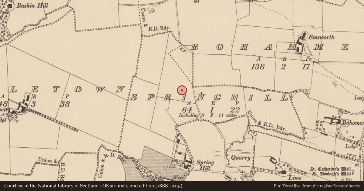
Enclosure
Springhill, County Dublin, Ireland
The record
- Townland
- Springhill
- County
- Dublin
- Country
- Ireland
- Latest-edition OS map
- Not indicated
- Coordinates
- 53.41908, -6.19077
- SMR number
- DU015-057----
Slide toward Today to fade the historical sheet and see the modern map underneath.
David Rumsey Map Collection, Stanford LibrariesDavid Rumsey Map Collection, Stanford LibrariesDavid Rumsey Map Collection, Stanford LibrariesDavid Rumsey Map Collection, Stanford Libraries
4 historical maps cover this location, the earliest the 1799 map "Ireland." (David Rumsey Map Collection, Stanford Libraries).
Historical maps covering this location
- 1799 · Ireland. (David Rumsey Map Collection, Stanford Libraries)
- 1811 · Ireland. (David Rumsey Map Collection, Stanford Libraries)
- 1841 · Ireland. (David Rumsey Map Collection, Stanford Libraries)
- 1891 · Ireland 16 (David Rumsey Map Collection, Stanford Libraries)
This record in the National Monuments Service's Historic Environment Viewer ↗
The National Monuments Service's description
Located on slight east west rise within massive open field-field boundaries long since removed. Extensive views to the high land of the north and sourth to the Dublin Mountains. Just to the east is an ancient road (DU015-125----). Visible as cropmark on Bing aerial (viewed 28/01/2015). A geophysical survey (Licence no. 08R0326) of the site was undertaken in advance of a proposed road realignment. A fragmented curvilinear response 38m in diameter thought to represent a sub-circular ditched enclosure was identified. Within interior are several pit type responses as well as pits, postholes, ditches and gullies. Probable entrance to the south into what appears to be an annex. Within this area there is thought to be burning or burnt material. An outer ditch was also identified and although responses were faint it would appear to measure 57mEW x 69mNS (Harrison 2008).
Compiled by: Christine Baker
Date of upload: 28 January 2015
References
Harrison, D. 2008 Geophysical Survey Report: Realignment of the R107 Malahide Road, North County Dublin (Licence no. 08R0326). Unpublished report submitted to the National Monuments Servive, Department of Arts, Heritage and the Gaeltacht.
Nearby in the register
- Road - road/trackwayunder 1 mi
- Ring-ditchunder 1 mi
- Ring-ditchunder 1 mi
- Ring-ditchunder 1 mi
Other entries of the same register within about three miles of this one, by straight line.