Sites and Monuments Record · Ireland
House - 16th/17th century
Corduff (Castleknock By.), County Dublin, Ireland
The record
- Townland
- Corduff (Castleknock By.)
- County
- Dublin
- Country
- Ireland
- Latest-edition OS map
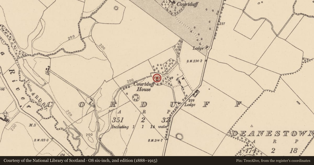
- Courtduff House
- Coordinates
- 53.39881, -6.37887
- SMR number
- DU013-025----
Slide toward Today to fade the historical sheet and see the modern map underneath.
David Rumsey Map Collection, Stanford LibrariesDavid Rumsey Map Collection, Stanford LibrariesDavid Rumsey Map Collection, Stanford LibrariesDavid Rumsey Map Collection, Stanford Libraries
4 historical maps cover this location, the earliest the 1790 map "Composite: Ireland." (David Rumsey Map Collection, Stanford Libraries).
Historical maps covering this location
- 1790 · Composite: Ireland. (David Rumsey Map Collection, Stanford Libraries)
- 1799 · Ireland. (David Rumsey Map Collection, Stanford Libraries)
- 1811 · Ireland. (David Rumsey Map Collection, Stanford Libraries)
- 1891 · Ireland 16 (David Rumsey Map Collection, Stanford Libraries)
This record in the National Monuments Service's Historic Environment Viewer ↗
The National Monuments Service's description
There is a large multi-gabled dwelling marked on the Down Survey (1655-6) map compiled. The Civil Survey (1654-6) mentions a 'stone house, slated' (Simington 1945, 246). Possibly incorporated into the make-up of the later Corduff House. Test excavation and monitoring (Licence no. 05E0360) were undertaken in advance of the construction of a sports hall. The vestiges of eight rooms representing the foundation level of the later house, part of a tiled area from the ground floor and remnants of a pond 20m north of the house location were excavated (Carroll, 2006).
Compiled by: Geraldine Stout
Updated by: Christine Baker
Date of upload: 20 January 2015
References
Simington, R.C. (ed.) 1945 The Civil survey, AD 1654-1656. Vol. VII: county of Dublin. Dublin. Irish Manuscripts Commission.
Carroll, J. 2006 Archaeological Excavation, Corduff Community Campus, Corduff Park, Blanchardtown, Dublin 15 (Licence no. 05E0360). Unpublished report submitted to the National Monuments Service, Department of Arts, Heritage and the Gaeltacht.
Nearby in the register
- Ringfort - unclassifiedunder 1 mi
- Ringfort - unclassifiedunder 1 mi
- Moundunder 1 mi
- House - 16th/17th centuryunder 1 mi
Other entries of the same register within about three miles of this one, by straight line.