Sites and Monuments Record · Ireland
Wall monument (present location)
Donabate, County Dublin, Ireland
The record
- Townland
- Donabate
- County
- Dublin
- Country
- Ireland
- Coordinates
- 53.48553, -6.15446
- SMR number
- DU012-005004-
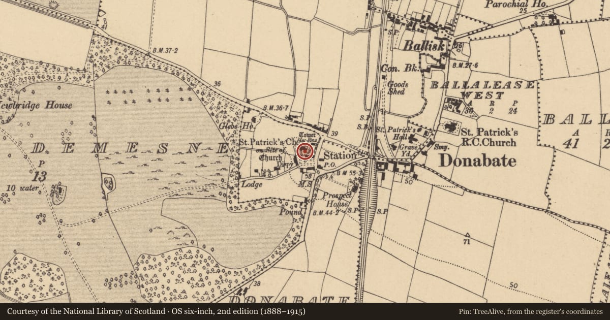
Slide toward Today to fade the historical sheet and see the modern map underneath.
David Rumsey Map Collection, Stanford LibrariesDavid Rumsey Map Collection, Stanford LibrariesDavid Rumsey Map Collection, Stanford LibrariesDavid Rumsey Map Collection, Stanford Libraries
4 historical maps cover this location, the earliest the 1799 map "Ireland." (David Rumsey Map Collection, Stanford Libraries).
Historical maps covering this location
- 1799 · Ireland. (David Rumsey Map Collection, Stanford Libraries)
- 1811 · Ireland. (David Rumsey Map Collection, Stanford Libraries)
- 1841 · Ireland. (David Rumsey Map Collection, Stanford Libraries)
- 1891 · Ireland 16 (David Rumsey Map Collection, Stanford Libraries)
This record in the National Monuments Service's Historic Environment Viewer ↗
The National Monuments Service's description
There are 18th-century and earlier graveslabs in the porch of St Patrick's church of Ireland including one dedicated to John Fitzsimon (d. 1709) and a monument to Patrick Barnewall of Staffordstown and his wife Begnot de La Hoyde who died in 1592. The later contains an inscription and two coats of arms (Healy 1975, 25).
Compiled by: Geraldine Stout
Updated by: Christine Baker
Date of upload: 16 January 2015
References
Healy, P. 1975b Third report on monuments and sites of archaeological interest in county Dublin. An Foras Forbartha, Dublin.
Healy, P. 1975a Second report on monuments and sites of archaeological interest in county Dublin. An Foras Forbartha Teoranta.
Nearby in the register
- Churchunder 1 mi
- Graveyardunder 1 mi
- Castle - tower houseunder 1 mi
- Excavation - miscellaneousunder 1 mi
Other entries of the same register within about three miles of this one, by straight line.