Sites and Monuments Record · Ireland
Castle - motte and bailey
Brazil, County Dublin, Ireland
The record
- Townland
- Brazil
- County
- Dublin
- Country
- Ireland
- Latest-edition OS map
- Hachured
- Coordinates
- 53.45817, -6.26687
- SMR number
- DU011-027----
Slide toward Today to fade the historical sheet and see the modern map underneath.
David Rumsey Map Collection, Stanford LibrariesDavid Rumsey Map Collection, Stanford LibrariesDavid Rumsey Map Collection, Stanford LibrariesDavid Rumsey Map Collection, Stanford Libraries
4 historical maps cover this location, the earliest the 1799 map "Ireland." (David Rumsey Map Collection, Stanford Libraries).
Historical maps covering this location
- 1799 · Ireland. (David Rumsey Map Collection, Stanford Libraries)
- 1811 · Ireland. (David Rumsey Map Collection, Stanford Libraries)
- 1841 · Ireland. (David Rumsey Map Collection, Stanford Libraries)
- 1891 · Ireland 16 (David Rumsey Map Collection, Stanford Libraries)
This record in the National Monuments Service's Historic Environment Viewer ↗
The National Monuments Service's description
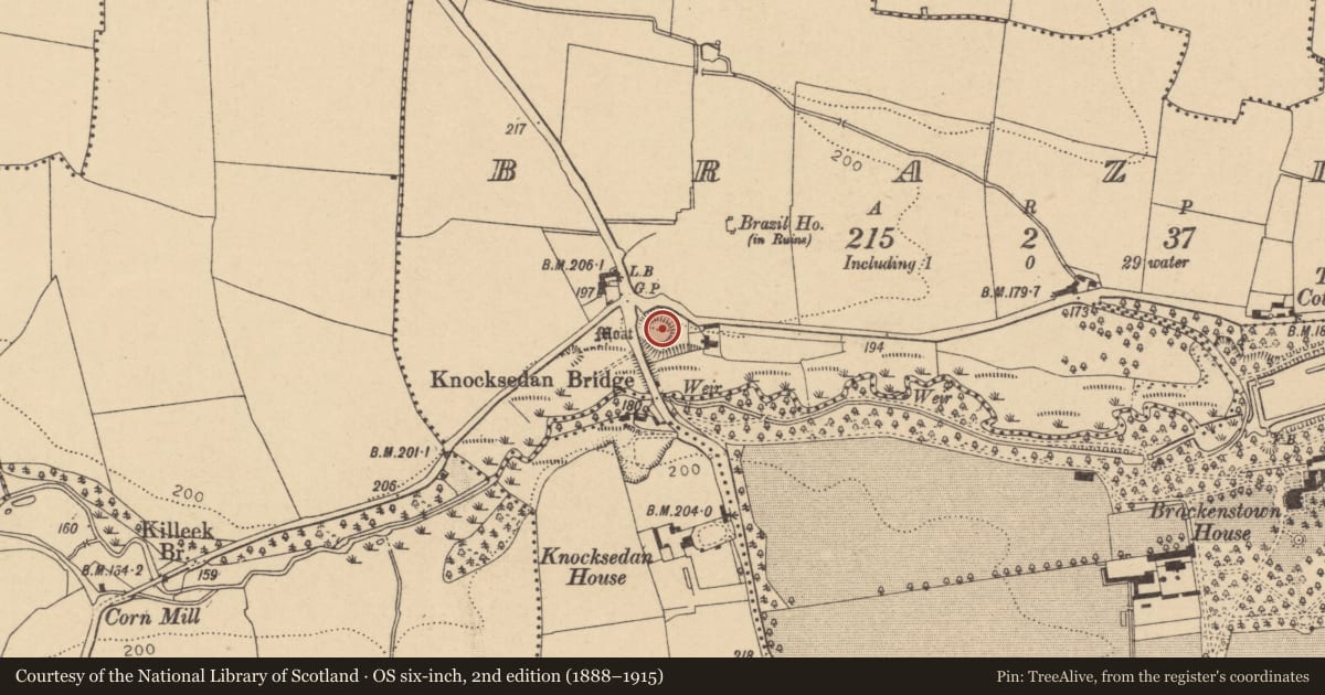
Located within the Ward river valley north of Knocksedan bridge and east of the old coach road north through Fingal. Abutted to north and west by road and south by river, the site comprises a flat-topped mound (diam.25m; H 6m) which is surrounded by a deep V-shaped fosse best preserved at north and northeast (Wth 8m; D 1.5m). There are faint traces of an outer bank along the west side. The bailey, is recorded as being located on the opposite side of the road as a level raised area (dims.56m E-W; 70m N-S H 0.5m) (Healy 1975, 23). However to the east of the now overgrown mound is a flat area that slopes down and could constitute part of the bailey. The motte will be included in the planned Ward River Valley Park.
Compiled by: Geraldine Stout
Updated by: Christine Baker
Date of upload: 03 January 2015
This monument is subject to a preservation order made under the National Monuments Acts 1930 to 2014 (PO no. 8/1983).
References
Healy, P. 1975a Second report on monuments and sites of archaeological interest in county Dublin. An Foras Forbartha Teoranta.
Healy, P. 1975b Third report on monuments and sites of archaeological interest in county Dublin. An Foras Forbartha, Dublin.
Nearby in the register
- Bridgeunder 1 mi
- House - 16th/17th centuryunder 1 mi
- Moundunder 1 mi
- Enclosureunder 1 mi
Other entries of the same register within about three miles of this one, by straight line.