Sites and Monuments Record · Ireland
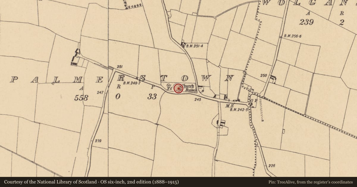
Graveyard
Palmerstown (Balrothery West By.), County Dublin, Ireland
The record
- Townland
- Palmerstown (Balrothery West By.)
- County
- Dublin
- Country
- Ireland
- First-edition OS map
- Burial Ground
- Latest-edition OS map
- Grave Yard
- Coordinates
- 53.51152, -6.35360
- SMR number
- DU007-013003-
Slide toward Today to fade the historical sheet and see the modern map underneath.
David Rumsey Map Collection, Stanford LibrariesDavid Rumsey Map Collection, Stanford LibrariesDavid Rumsey Map Collection, Stanford LibrariesDavid Rumsey Map Collection, Stanford Libraries
4 historical maps cover this location, the earliest the 1790 map "Composite: Ireland." (David Rumsey Map Collection, Stanford Libraries).
Historical maps covering this location
- 1790 · Composite: Ireland. (David Rumsey Map Collection, Stanford Libraries)
- 1799 · Ireland. (David Rumsey Map Collection, Stanford Libraries)
- 1811 · Ireland. (David Rumsey Map Collection, Stanford Libraries)
- 1891 · Ireland 16 (David Rumsey Map Collection, Stanford Libraries)
This record in the National Monuments Service's Historic Environment Viewer ↗
The National Monuments Service's description
Located within a field of corn with holy well (DU007-013002-) 50m to S. D-shaped or roughly circular-shape graveyard (diam. 25m) defined by a high 'post-1700 stone wall, circular in plan with gated entrance and stile to S. Internal concrete pathway around the perimeter, with foundations of medieval church ruins (DU007-013001-) at high point in centre of graveyard. Field boundary curved to W mirroring graveyard, may imply presence of an early Christian ecclesiastical enclosure. Extensive views south to Wicklow/Dublin Mountains. Grave markers date from 18th century to modern. One of the earliest markers dedicated to Peter Duff 1774 (Fingal Historic Graveyard Project). Still in use.
Compiled by: Geraldine Stout
Updated by: Christine Baker
Revised by: Caimin O'Brien
Date of revised upload: 24 March 2023
References
Fingal Historic Graveyards Project 2008, Vols. 1 and 2 http://www.fingal.ie/planning-and-buildings/heritage-in-fingal/heritage-and-communities/historic-graveyards/
Nearby in the register
- Churchunder 1 mi
- Ritual site - holy wellunder 1 mi
- Ring-ditchunder 1 mi
- House - 16th/17th centuryunder 1 mi
Other entries of the same register within about three miles of this one, by straight line.