Sites and Monuments Record · Ireland
Ecclesiastical site
Grallagh, County Dublin, Ireland
The record
- Townland
- Grallagh
- County
- Dublin
- Country
- Ireland
- First-edition OS map
- Partially indicated
- Latest-edition OS map
- Partially indicated
- Coordinates
- 53.54642, -6.33042
- SMR number
- DU007-001006-
Slide toward Today to fade the historical sheet and see the modern map underneath.
David Rumsey Map Collection, Stanford LibrariesDavid Rumsey Map Collection, Stanford LibrariesDavid Rumsey Map Collection, Stanford LibrariesDavid Rumsey Map Collection, Stanford Libraries
4 historical maps cover this location, the earliest the 1790 map "Composite: Ireland." (David Rumsey Map Collection, Stanford Libraries).
Historical maps covering this location
- 1790 · Composite: Ireland. (David Rumsey Map Collection, Stanford Libraries)
- 1799 · Ireland. (David Rumsey Map Collection, Stanford Libraries)
- 1811 · Ireland. (David Rumsey Map Collection, Stanford Libraries)
- 1891 · Ireland 16 (David Rumsey Map Collection, Stanford Libraries)
This record in the National Monuments Service's Historic Environment Viewer ↗
The National Monuments Service's description
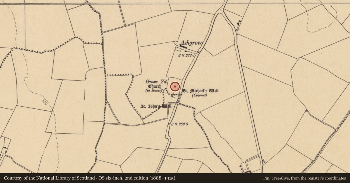
Grallagh church (DU007-001001-), graveyard (DU007-001004-), holy well (DU007-001002-) and holy stone (DU007-001003-) may have been built on the site of an early Christian monastery (DU007-001006-) founded by St Maccallin. Situated on undulating pasture, with poorly drained land immediately to S and higher well drained land to N and E. St John's Well (DU007-002----) lies 60m to S. Grallagh (An Ghreallach/miry place) graveyard (DU007-001004-) appears to have been a smaller circular-shaped burial ground enclosed by a bank with external fosse that was extended to the N forming the present large sub-rectangular shaped graveyard (H. A. Wheeler Report 15/04/1975, SMR File). It is possible that the curving boundary ditch represents the remains of an early Christian enclosure (DU007-001005-) associated with a monastery (DU007-001006-) founded by St Maccallin/Maccullin. The curving S boundary of the graveyard marks the boundary with Cottrelstown townland.
Compiled by: Caimin O'Brien
Date of upload: 4 April 2023
Nearby in the register
- Graveyardunder 1 mi
- Ecclesiastical enclosureunder 1 mi
- Churchunder 1 mi
- Ritual site - holy wellunder 1 mi
Other entries of the same register within about three miles of this one, by straight line.