Sites and Monuments Record · Ireland
Pit-burial
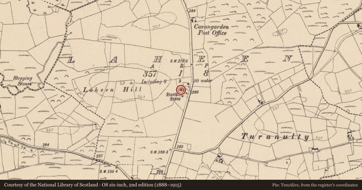
Laheen, County Donegal, Ireland
The record
- Townland
- Laheen
- County
- Donegal
- Country
- Ireland
- First-edition OS map
- Not indicated
- Latest-edition OS map
- Not indicated
- Coordinates
- 54.53559, -8.13977
- SMR number
- DG103-064----
Slide toward Today to fade the historical sheet and see the modern map underneath.
David Rumsey Map Collection, Stanford LibrariesDavid Rumsey Map Collection, Stanford LibrariesDavid Rumsey Map Collection, Stanford LibrariesDavid Rumsey Map Collection, Stanford Libraries
4 historical maps cover this location, the earliest the 1881 map "Ireland to Illustrate the Military Condition of the Country." (David Rumsey Map Collection, Stanford Libraries).
Historical maps covering this location
- 1881 · Ireland to Illustrate the Military Condition of the Country. (David Rumsey Map Collection, Stanford Libraries)
- 1891 · Ireland 16 (David Rumsey Map Collection, Stanford Libraries)
- 1904 · Sheet 4. (David Rumsey Map Collection, Stanford Libraries)
- 1922 · Ireland - northern section. (David Rumsey Map Collection, Stanford Libraries)
This record in the National Monuments Service's Historic Environment Viewer ↗
The National Monuments Service's description
Located on a slight gravel ridge in farmland. This marks the approximate location of a Bronze Age pit-burial uncovered in 1964 in a tillage field, at a depth of c. 10cm below surface. It consisted of a circular pit (diam. 0.5m; D 0.35m) sealed at top by a stone slab (L 0.54m; Wth 0.46m; T 0.06m). In the base of the pit, a pottery urn was inverted over a pile of cremated bone. A polished stone mace-head lay adjacent to the urn on the SE side of the pit. The urn had collapsed and shattered in antiquity. It was identified as a Cordoned Urn, decorated with raised bands or cordons, with bands of zig-zag and horizontal twisted cord impressions on the neck and bevelled rim. Two decorated sherds of a smaller pot, possible a Food Vessel were also found. The highly polished and well-made stone mace-head has a splayed cutting edge, and an hour-glass-shaped central perforation, which would have held the shaft. A concave facet, defined on its outer edge by a well-defined groove, encloses the top of the central perforation on the two narrow faces of the axe (Ó Ríordáin 1967, 39-44). In the 1960's several flint blades and flakes were recovered from the surface of the tillage field, suggesting prehistoric settlement in the area (Lucas 1963, 119; Lucas 1967, 4-5). In 1966 a cist (DG103-065----), possibly also of Bronze Age date, was found c. 180 to S. There is a standing stone (DG103-063----) close by.
Compiled by: Jane O'Shaughnessy
Date of revised upload: 6 December 2017
References
Lucas, A.T. 1963 National Museum of Ireland: Archaeological acquisitions in the year 1961. Journal of the Royal Society of Antiquaries of Ireland 93, 115-33.
Lucas, A.T. 1967 Archaeological acquisitions 1964. Journal of the Royal Society of Antiquaries of Ireland 97 (1), 1-28.
Ó Ríordáin, A.B. 1967 Cordoned urn burial at Laheen, Co. Donegal. Journal of the Royal Society of Antiquaries of Ireland 97, 39-44.
Nearby in the register
- Standing stoneunder 1 mi
- Cistunder 1 mi
- Ringfort - rathunder 1 mi
- Ringfort - cashelunder 1 mi
Other entries of the same register within about three miles of this one, by straight line.