Sites and Monuments Record · Ireland
Ringfort - rath
Cool Beg, County Donegal, Ireland
The record
- Townland
- Cool Beg
- County
- Donegal
- Country
- Ireland
- Coordinates
- 54.54562, -8.22319
- SMR number
- DG103-034----
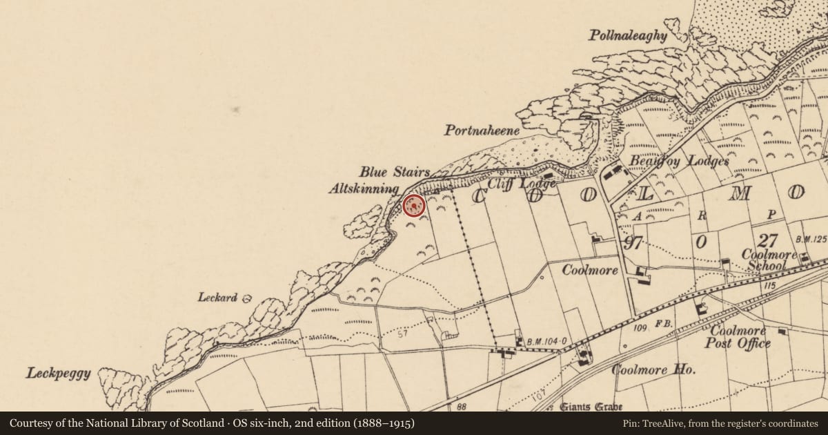
Slide toward Today to fade the historical sheet and see the modern map underneath.
David Rumsey Map Collection, Stanford LibrariesDavid Rumsey Map Collection, Stanford LibrariesDavid Rumsey Map Collection, Stanford LibrariesDavid Rumsey Map Collection, Stanford Libraries
4 historical maps cover this location, the earliest the 1881 map "Ireland to Illustrate the Military Condition of the Country." (David Rumsey Map Collection, Stanford Libraries).
Historical maps covering this location
- 1881 · Ireland to Illustrate the Military Condition of the Country. (David Rumsey Map Collection, Stanford Libraries)
- 1891 · Ireland 16 (David Rumsey Map Collection, Stanford Libraries)
- 1904 · Sheet 4. (David Rumsey Map Collection, Stanford Libraries)
- 1922 · Ireland - northern section. (David Rumsey Map Collection, Stanford Libraries)
This record in the National Monuments Service's Historic Environment Viewer ↗
The National Monuments Service's description
Internal diam. 40m × 20m. A D-shaped area enclosed by an earthen bank, a fosse and an outer bank, parts of which are overgrown. To the NE within the enclosure there appears to be a slight platform-like rise with a depression at its centre. It is situated on a cliff edge overlooking the sea to the NW in good pasture land. To the SE is a valley which rises to the cliff face.
The above description was derived from the 'Archaeological Survey of County Donegal. A description of the field antiquities of the County from the Mesolithic Period to the 17th century.' Compiled by: Brian Lacey with Eamon Cody, Claire Cotter, Judy Cuppage, Noel Dunne, Vincent Hurley, Celie O'Rahilly, Paul Walsh and Seán Ó Nualláin (Lifford: Donegal County Council, 1983). In certain instances the entries have been revised and updated.
Date of upload: 22 September 2008
Nearby in the register
- Megalithic tomb - court tombunder 1 mi
- Ringfort - rathunder 1 mi
- Bullaun stoneunder 1 mi
- Ringfort - rathunder 1 mi
Other entries of the same register within about three miles of this one, by straight line.