Sites and Monuments Record · Ireland
Ecclesiastical enclosure
Kilkenny, County Donegal, Ireland
The record
- Townland
- Kilkenny
- County
- Donegal
- Country
- Ireland
- Coordinates
- 54.83602, -8.35433
- SMR number
- DG065-014002-
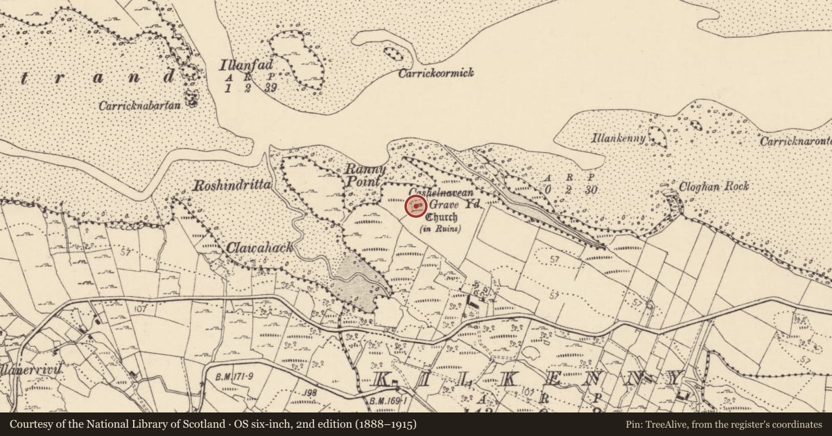
Slide toward Today to fade the historical sheet and see the modern map underneath.
David Rumsey Map Collection, Stanford LibrariesDavid Rumsey Map Collection, Stanford LibrariesDavid Rumsey Map Collection, Stanford LibrariesDavid Rumsey Map Collection, Stanford Libraries
4 historical maps cover this location, the earliest the 1881 map "Ireland to Illustrate the Military Condition of the Country." (David Rumsey Map Collection, Stanford Libraries).
Historical maps covering this location
- 1881 · Ireland to Illustrate the Military Condition of the Country. (David Rumsey Map Collection, Stanford Libraries)
- 1891 · Ireland 16 (David Rumsey Map Collection, Stanford Libraries)
- 1904 · Sheet 1. (David Rumsey Map Collection, Stanford Libraries)
- 1922 · Ireland - northern section. (David Rumsey Map Collection, Stanford Libraries)
This record in the National Monuments Service's Historic Environment Viewer ↗
The National Monuments Service's description
A Chapel of Ease (DG065-014001-) to Inishkeel. Pococke (1752, 67) described it as 'an old church called Kilkenny'. Built of rubble, the surviving fragmentary ruins of this church, 9.6m by 4.6m internally, are undateable. The E and W gables are represented by grass-covered footings and only the central sections of the N and S walls 2.2m high remain; at the W end of the latter is the splayed ingoing of a window. The church stands in the middle of a rectangular modern graveyard (DG065-014003-). To the N and W of this graveyard is the outline of a curving enclosure (DG065-014002-). Most of a semicircle can be seen. No sign of the enclosure could be found to the E and S but the modern graveyard and church would have stood roughly at the centre of such a circle had this been originally complete. The enclosure is formed by a grassed-over wall c. 0.25m high and up to 1.4m wide. Sections of the wall-footing are visible. In places, the wall was built along the edge of a slope to the sea. There is a 3.5m gap in the wall to the W where the S side is definitely inturned for 7.3m. The site is located on fair pasture land on the S side of the Gweebarra river inlet.
The above description was derived from the 'Archaeological Survey of County Donegal. A description of the field antiquities of the County from the Mesolithic Period to the 17th century.' Compiled by: Brian Lacey with Eamon Cody, Claire Cotter, Judy Cuppage, Noel Dunne, Vincent Hurley, Celie O'Rahilly, Paul Walsh and Seán Ó Nualláin (Lifford: Donegal County Council, 1983). In certain instances the entries have been revised and updated.
Date of upload: 22 September 2008
Nearby in the register
Other entries of the same register within about three miles of this one, by straight line.