Sites and Monuments Record · Ireland
Rock art
Magheestown, County Donegal, Ireland
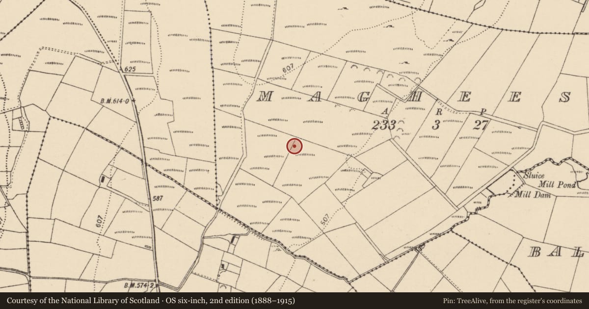
The record
- Townland
- Magheestown
- County
- Donegal
- Country
- Ireland
- Latest-edition OS map
- Not indicated
- Coordinates
- 54.89492, -7.59371
- SMR number
- DG062-035----
Slide toward Today to fade the historical sheet and see the modern map underneath.
David Rumsey Map Collection, Stanford LibrariesDavid Rumsey Map Collection, Stanford LibrariesDavid Rumsey Map Collection, Stanford LibrariesDavid Rumsey Map Collection, Stanford Libraries
4 historical maps cover this location, the earliest the 1881 map "Ireland to Illustrate the Military Condition of the Country." (David Rumsey Map Collection, Stanford Libraries).
Historical maps covering this location
- 1881 · Ireland to Illustrate the Military Condition of the Country. (David Rumsey Map Collection, Stanford Libraries)
- 1891 · Ireland 16 (David Rumsey Map Collection, Stanford Libraries)
- 1900 · Ireland (David Rumsey Map Collection, Stanford Libraries)
- 1904 · Sheet 1. (David Rumsey Map Collection, Stanford Libraries)
This record in the National Monuments Service's Historic Environment Viewer ↗
The National Monuments Service's description
Approximately 15m W of an unclassified megalithic tomb possible (DG062-036----) and towards the NW corner of the field the surface of a large slab of rock bears rock art motifs (SMR file; pers. comm. E. Cody 1998).
Situated on a SSW-facing hillside in wet, rough pasture. At the location indicated is a large, naturally-occurring flat outcrop outcrop (L 3.95m NW-SE; 2.3m NE-SW) with many crevices of varying sizes and indentations, some of which at first looked to be artificial but on closer inspection turned out to be naturally-occurring. On the exposed surface of this stone are 12 simple cups, 4 cup and circles, 3 cups within twin concentic circles and a single cup within twin concentric circles which is divided into four approximately equal portions by linear vertical and horizontal indentations. To the NE of this stone is a second, much smaller stone (c.1m NW-SE; 0.7m NE-SW), which is part of the outcrop. On its upper surface is 2 simple cups, 1 cup and circle and 1 cup within twin concentric circles. At N is a smaller irregularly-shaped stone which is not part of the outcrop (0.55m NW-SE; 0.6m NE-SW; H 0.4m). On its upper surface is 1 simple cup and twin cups within an oval setting. Immediately SSE of the large stone is a large, almost rectangular, undecorated slab which appears to be part of the outcrop. (E. Cody, Donegal Annual no. 50 (1998), pp 109-112).
Compiled by: Patrick F. O'Donovan
Date of upload: 12 August 2010
Nearby in the register
- Megalithic tomb - unclassifiedunder 1 mi
- Enclosureunder 1 mi
- Rock artunder 1 mi
- Megalithic tomb - unclassifiedunder 1 mi
Other entries of the same register within about three miles of this one, by straight line.