Sites and Monuments Record · Ireland
Flat cemetery
Drumhaggart, County Donegal, Ireland
The record
- Townland
- Drumhaggart
- County
- Donegal
- Country
- Ireland
- Coordinates
- 55.06595, -7.34078
- SMR number
- DG039-012----
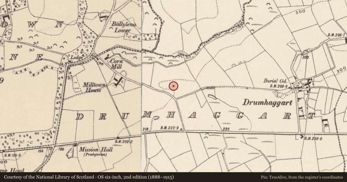
Slide toward Today to fade the historical sheet and see the modern map underneath.
David Rumsey Map Collection, Stanford LibrariesDavid Rumsey Map Collection, Stanford LibrariesDavid Rumsey Map Collection, Stanford LibrariesDavid Rumsey Map Collection, Stanford Libraries
4 historical maps cover this location, the earliest the 1881 map "Ireland to Illustrate the Military Condition of the Country." (David Rumsey Map Collection, Stanford Libraries).
Historical maps covering this location
- 1881 · Ireland to Illustrate the Military Condition of the Country. (David Rumsey Map Collection, Stanford Libraries)
- 1891 · Ireland 16 (David Rumsey Map Collection, Stanford Libraries)
- 1900 · Ireland (David Rumsey Map Collection, Stanford Libraries)
- 1904 · Sheet 1. (David Rumsey Map Collection, Stanford Libraries)
This record in the National Monuments Service's Historic Environment Viewer ↗
The National Monuments Service's description
In 1950 'six cists containing cremated remains were found. One of the cists also contained an undecorated biconical miniature vessel (1956:428). The site was not investigated by NMI staff and the only report extant is that written by Garda B. McTernan. Ó Donnabháin and Brindley (1989-90, 19-20) reported that the bones associated with the miniature vesselwere those of a young adult female. A piece of unburnt antler was also found. The human remains have not been dated. Brindley (2007, 294) suggests that biconical miniature vessels date from c.1900-1800 BC.' (Cahill and Sikora 2011, Vol. 1, 114). (Waddell 1970, 113; Lacy et al. 1983, 65; Ó Donnabháin and Brindley 1989-90; Brindley 2007).
Compiled by: Patrick F. O'Donovan
Date of upload: 18 February 2013
References
Cahill, M. and Sikora, M. (eds) 2011 Breaking ground, finding graves - reports on the excavations of burials by the National Museum of Ireland, 1927-2006, 2 vols. Dublin. Wordwell Ltd. in association with the National Museum of Ireland.
Lacy, B. with Cody, E., Cotter, C., Cuppage, J., Dunne, N., Hurley, V., O'Rahilly, C., Walsh, P. and Ó Nualláin, S. 1983 Archaeological Survey of County Donegal. A description of the field antiquities of the County from the Mesolithic Period to the 17th century A.D. Lifford. Donegal County Council.
Waddell, J. 1970 Irish Bronze Age cists, a survey. Journal of the Royal Society of Antiquaries of Ireland 100, 91-139.
Brindley, A.L. 2007 The Dating of Food Vessels and Urns in Ireland, Bronze Age Studies 7. National University of Ireland, Galway.
Ó Donnabháin, B. and Brindley, A.L. 1989-90 The status of children in a sample of Bronze Age burials containing pygmy cups. Journal of Irish Archaeology 5, 19-24
Nearby in the register
- Pit-burialunder 1 mi
- Urn burialunder 1 mi
- Ringfort - rathunder 1 mi
- Ringfort - rath1 mi
Other entries of the same register within about three miles of this one, by straight line.