Sites and Monuments Record · Ireland
Midden
Carrickanee, County Donegal, Ireland
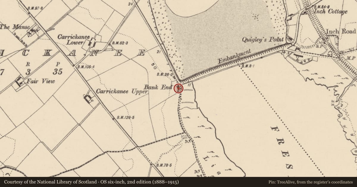
The record
- Townland
- Carrickanee
- County
- Donegal
- Country
- Ireland
- Latest-edition OS map
- Not indicated
- Coordinates
- 55.06117, -7.46244
- SMR number
- DG038-054----
Slide toward Today to fade the historical sheet and see the modern map underneath.
David Rumsey Map Collection, Stanford LibrariesDavid Rumsey Map Collection, Stanford LibrariesDavid Rumsey Map Collection, Stanford LibrariesDavid Rumsey Map Collection, Stanford Libraries
4 historical maps cover this location, the earliest the 1881 map "Ireland to Illustrate the Military Condition of the Country." (David Rumsey Map Collection, Stanford Libraries).
Historical maps covering this location
- 1881 · Ireland to Illustrate the Military Condition of the Country. (David Rumsey Map Collection, Stanford Libraries)
- 1891 · Ireland 16 (David Rumsey Map Collection, Stanford Libraries)
- 1900 · Ireland (David Rumsey Map Collection, Stanford Libraries)
- 1904 · Sheet 1. (David Rumsey Map Collection, Stanford Libraries)
This record in the National Monuments Service's Historic Environment Viewer ↗
The National Monuments Service's description
Described in 2001 as 'Harte referred to a shell midden which he discovered on the Inch Island end of the Inch Road embankment. With reference to the embankment he noted 'No 2 is at te opposite end on Inch Island'. While he referred also to a good section being evident he noted 'No 2 is nearly all removed for filling or manure'. Harte's observations that the sites 1, 2 and 3 were 12-14 feet from high water suggests that the three cottages built at the immediate end of the embankment may have removed any final remnant of the midden. The corner of the field immediately behind these cottages was examined and only occasional fragments of shell were noted in the topsoil. A small selection of flint artefacts had been recovered from the corner of this field' (Woodman & Milner 2001, 7-8; Milner & Woodman 2007, 104-5, No. 2).
Compiled by: Caimin O'Brien
Date of upload: 17 August 2010
References
Milner, N. and Woodman, P. 2007 Deconstructing the myths of Irish shell middens. In N. Milner, O.E. Craig and G. Bailey (eds) Shell middens in Atlantic Europe. Oxford. Oxbow.
Nearby in the register
- Middenunder 1 mi
- Ringfort - rathunder 1 mi
- Ringfort - unclassifiedunder 1 mi
- Ringfort - unclassifiedunder 1 mi
Other entries of the same register within about three miles of this one, by straight line.